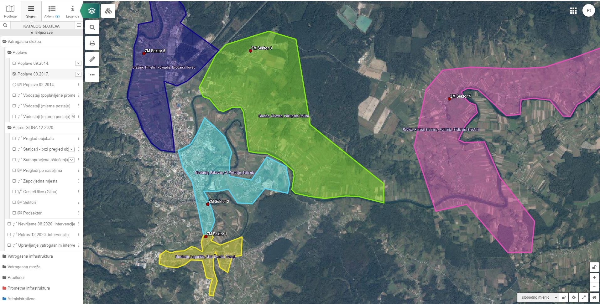
Critical zones
EXAMPLES
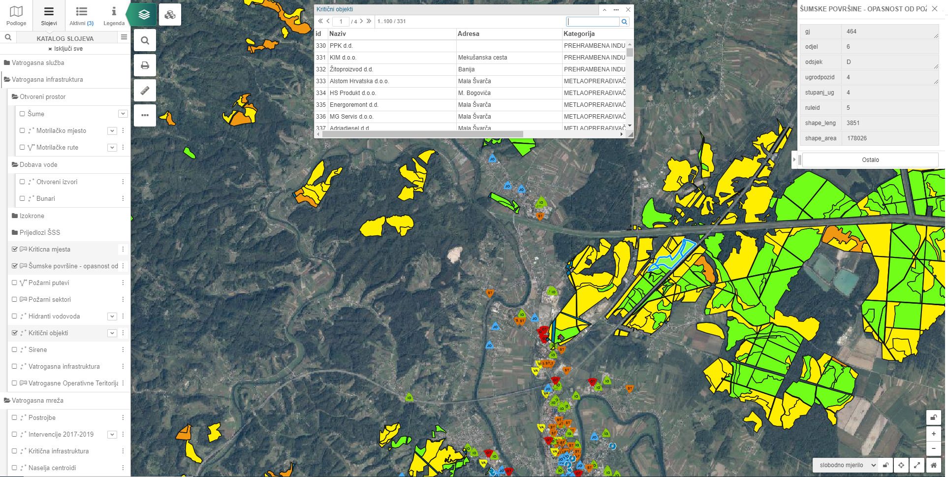
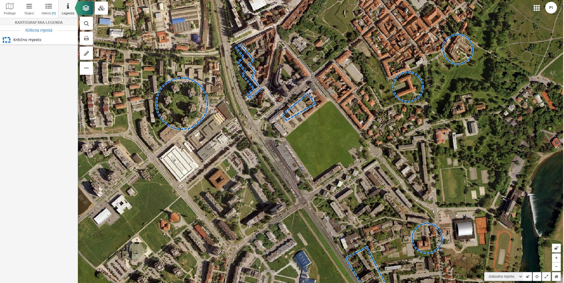
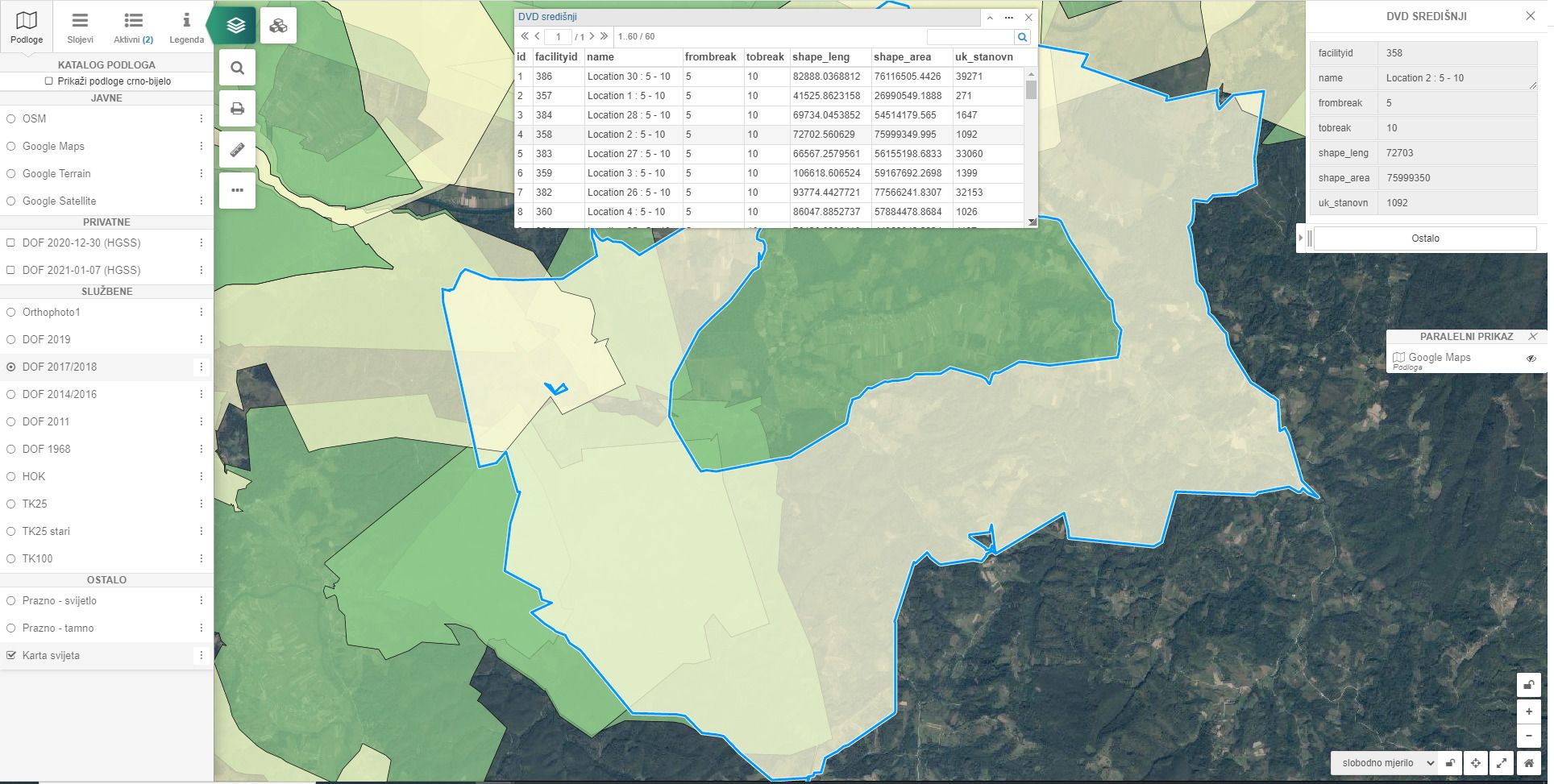
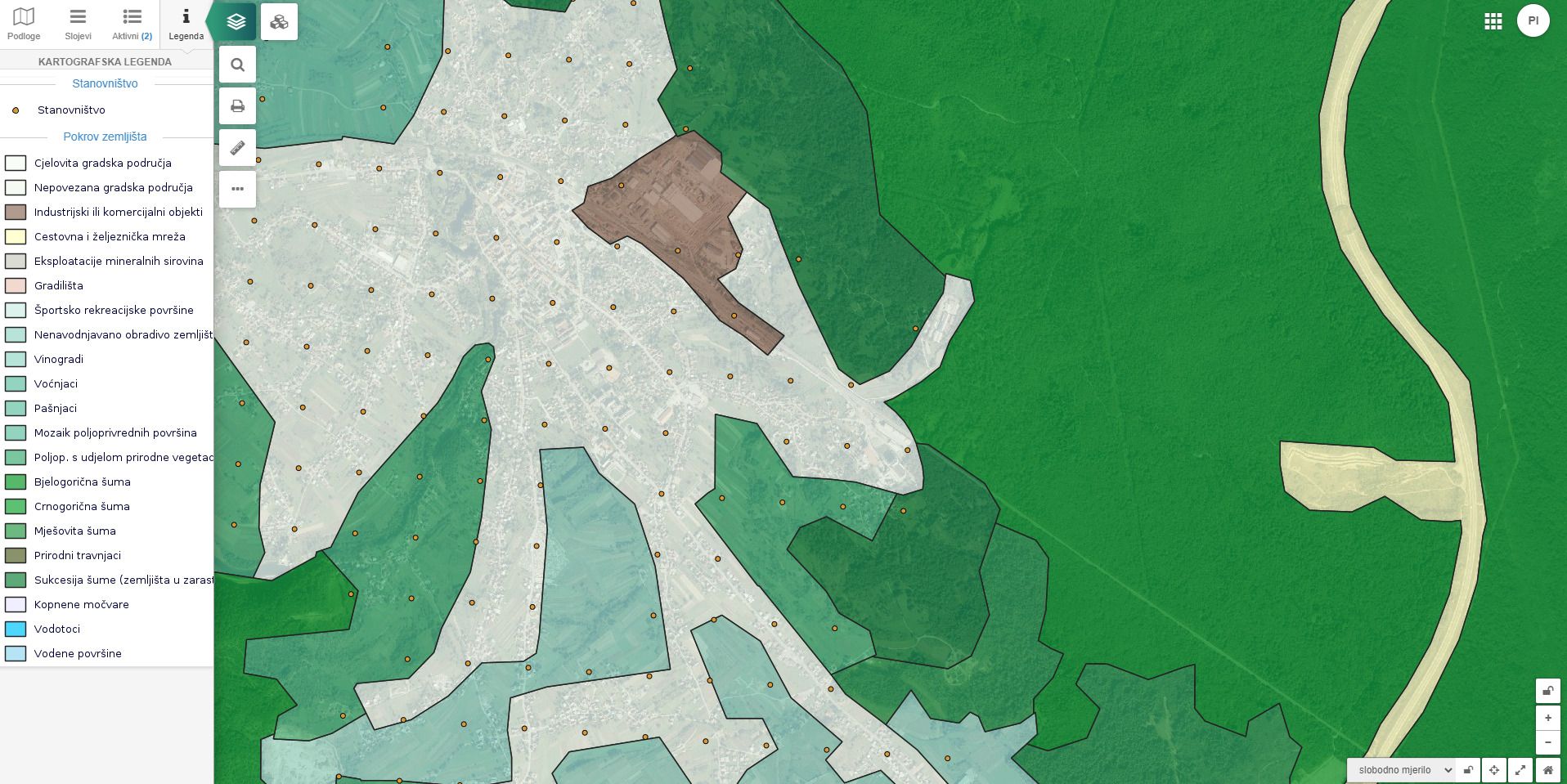
Visualization of critical zones on various cartographic bases adapted to individual user's needs. Display of zones with regard to the degree of danger of natural disasters.
The following data can be displayed:
- Floodplains
- Mine suspected areas
- Earthquake-prone areas
- Forest areas that are in danger of fire
- Stilization is adapted to individual user's needs
Provide funds to help mitigate and partially eliminate the consequences of natural disasters!
This overview provides a clear insight into the damage from a natural disaster and facilitates the development of an action plan in the event of natural disasters in the future.
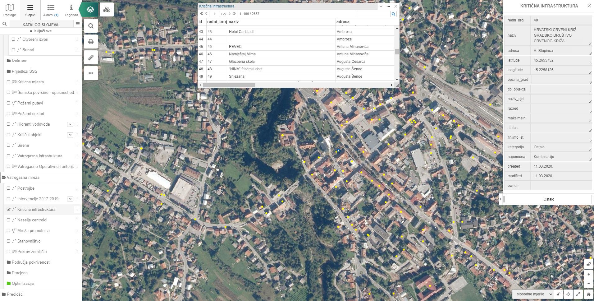
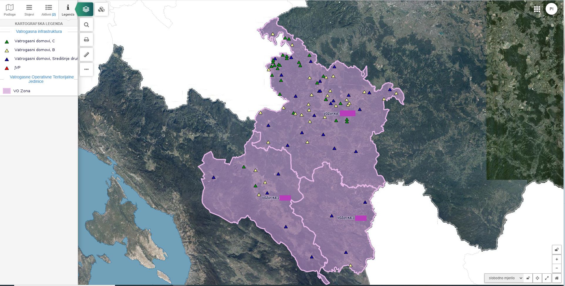
Infrastructure logistics
EXAMPLES
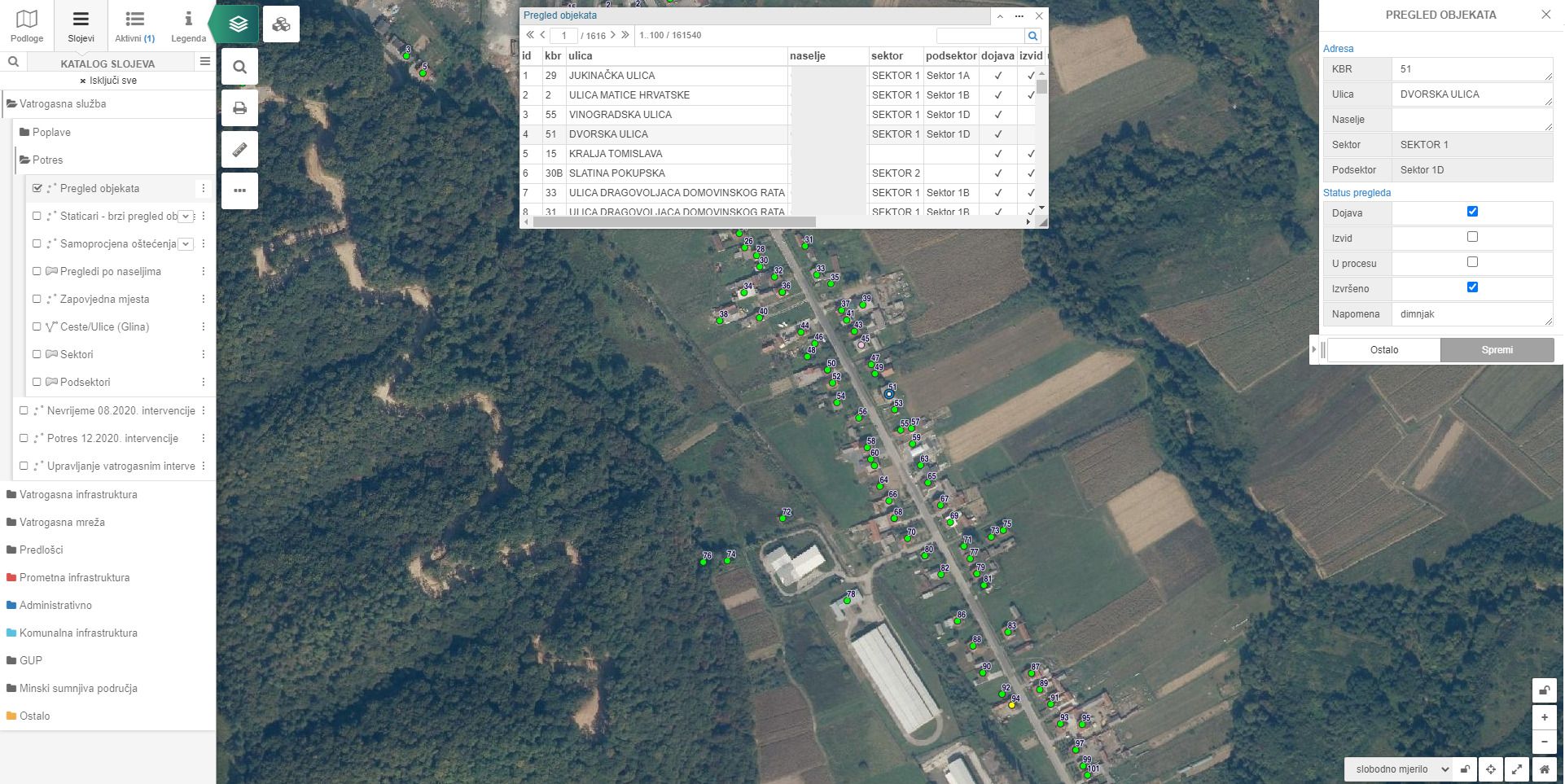
The ordinance on the Register of Damages from Natural Disasters prescribes the manner of submitting data on damages from natural disasters.
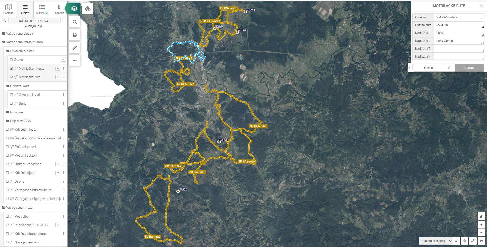
Overview of all emergency logistics:
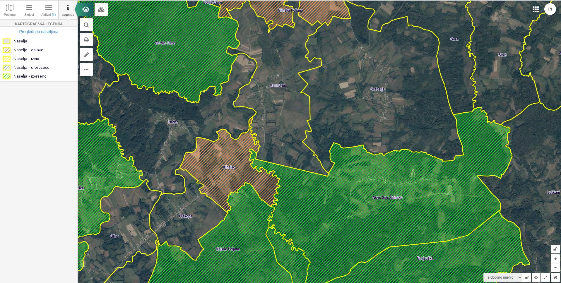
- Operational territorial units
- Monitoring of zones according to the speed of arrival of emergency services
- Evacuation rutes display
- Temporary traffic regulation - defining alternative routes
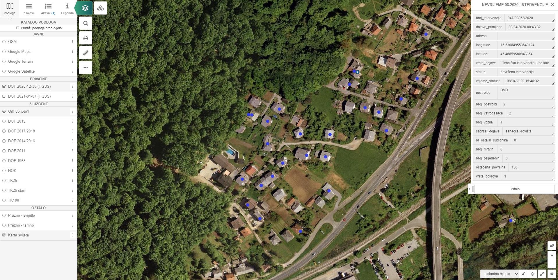
- Real-time monitoring of critical facilities (e.g. water level monitoring)
By displaying the entire logistics of emergency services, the assessment of the provision of equipment and other means for the protection and prevention of suffering of the population, economic functions and property has been simplified.
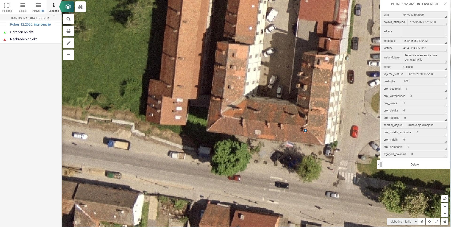
Crisis management system
EXAMPLES
A complex pipGIS solution designed specifically for managing emergency services before, during and after a disaster.
The module can have the following functionalities:
- Damage assessment (financial and natural indicators)
- Creating specialized reports in accordance with the Damage Register
- Organization of active participants according to the business of each unit
- Adaptation to field use with the possibility of determining the condition of individual facilities/areas after a disaster.
- Sending rescue/recovery work orders to superior units
- Communication can be extended to the general public, with citizens becoming active participants in the system
- Each intervention is spatially, temporally, categorically and financially recorded in the system throughout its development cycle