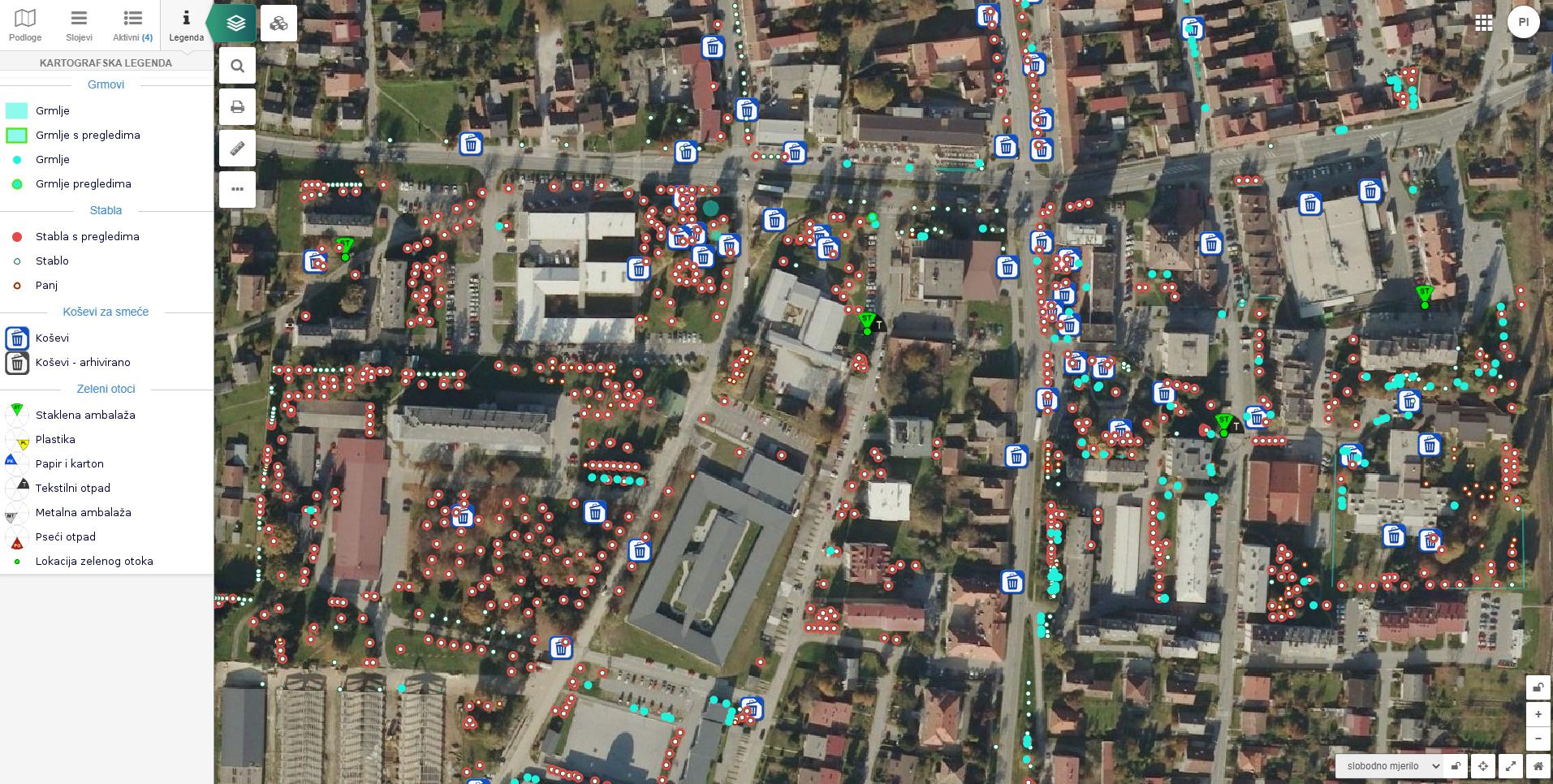
Waste management
EXAMPLES

The following data can be displayed:
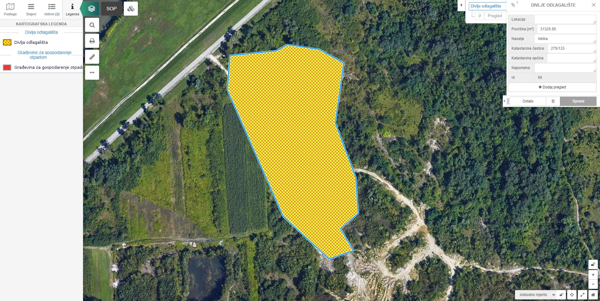
- Records of discarded waste locations
- Waste containers in households
- Waste management buildings
- Waste vehicle routes
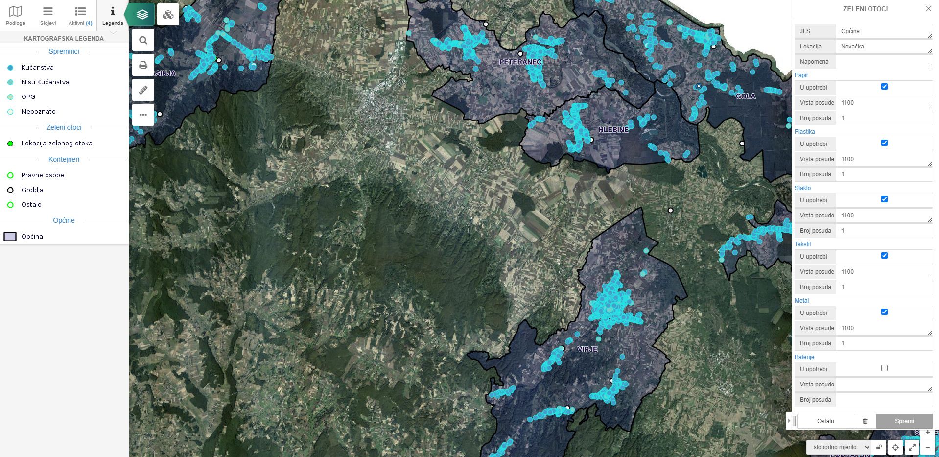
- "Zeleni otoci"
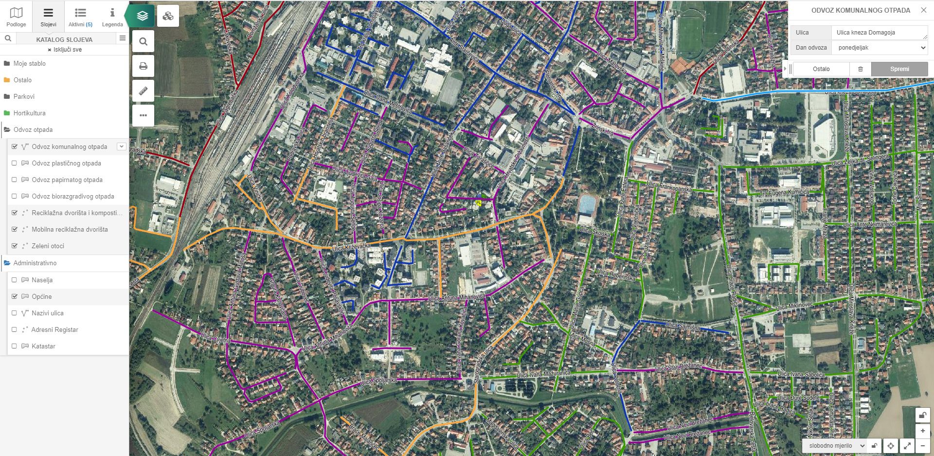
- Scheduling waste collection by type
- Mobile recycling yards
- Waste collection zones
Reduce environmental pollution problems locally and globally through a series of thoughtful waste management activities!
Waste management is optimized by a set of spatial data modules in accordance with the applicable law
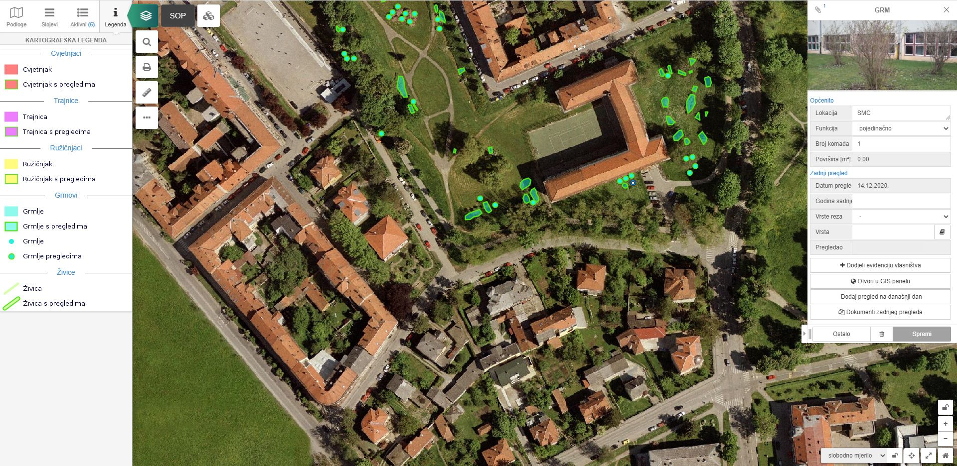
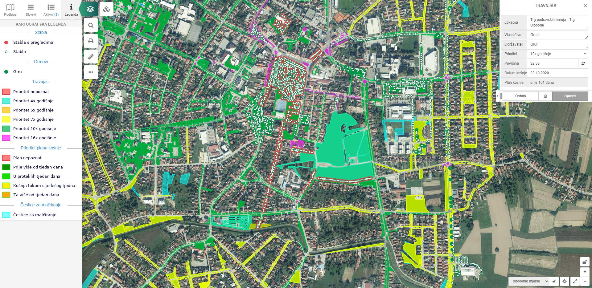
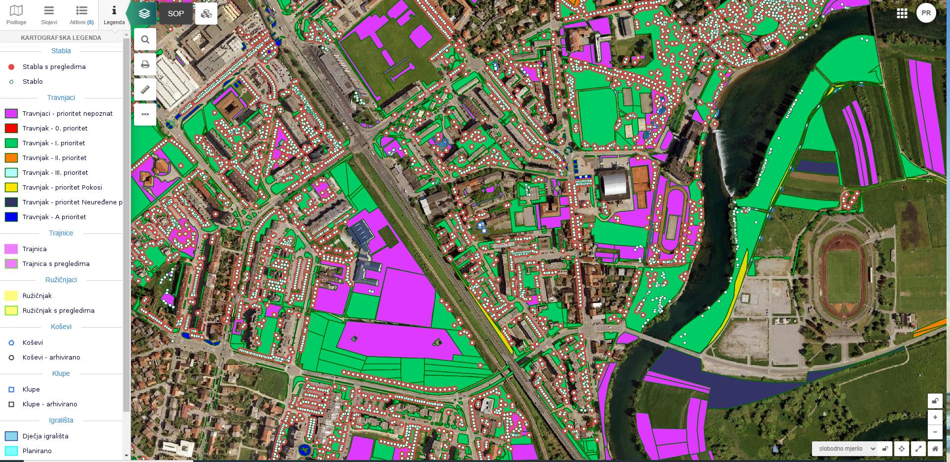
Green cadastre
The module can have the following functionalities:
- Representation of trees according to defined attributes: healthy, diseased, removed
- Division of lawns by priority
- Grass mowing plan
- Display of rose gardens, flower beds, bushes, hedges, etc.
- Review of individual items over a period of time
In addition, the following options are available:
- Interactive view and navigation of spatial data
- Possible integration with Google Earth application
- Basic tools for metric measurement of objects on the map
- Printing maps in standard and arbitrary scales
- Editing attribute and vector data via a web application
* Soultion designed specifically for local self-government units and adapted in accordance with the law
EXAMPLES
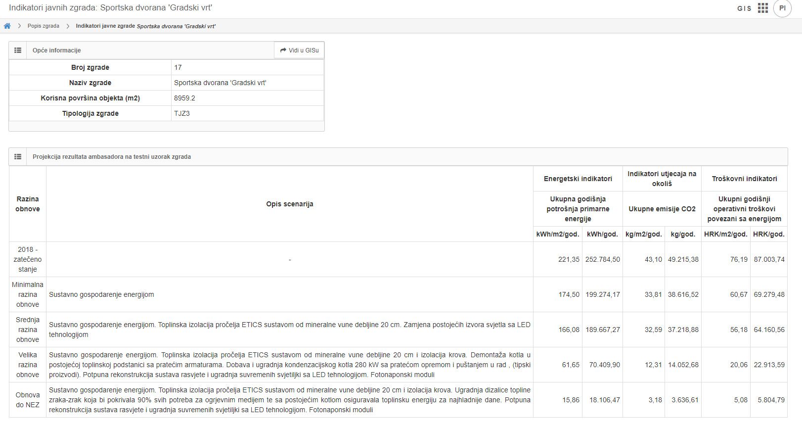
Climate and energy efficiency
EXAMPLES
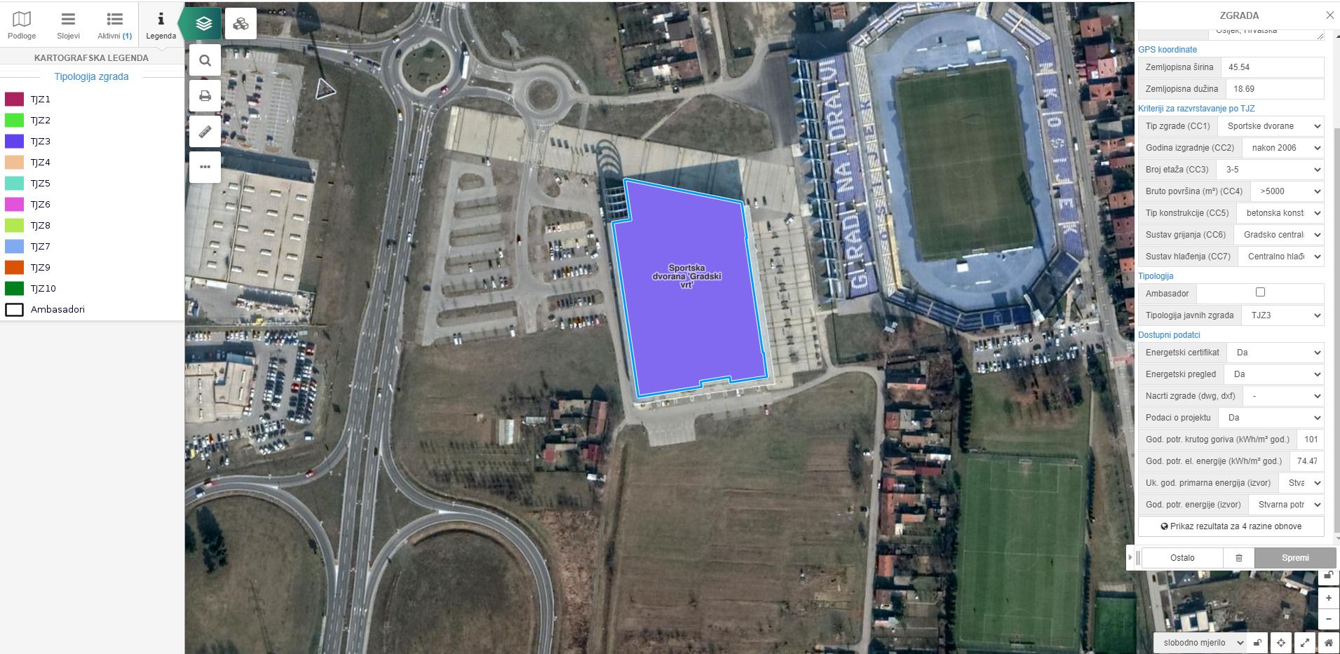
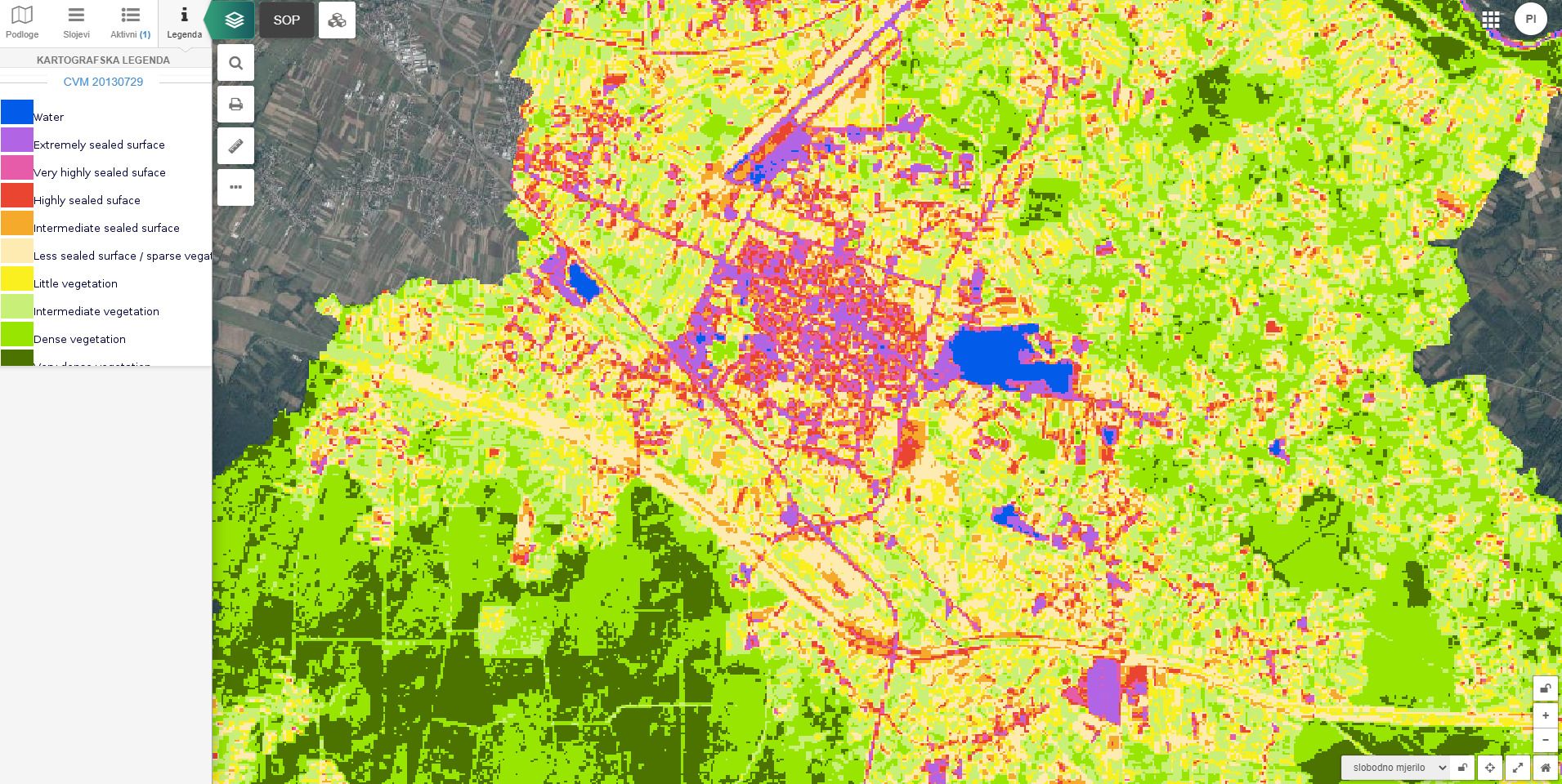
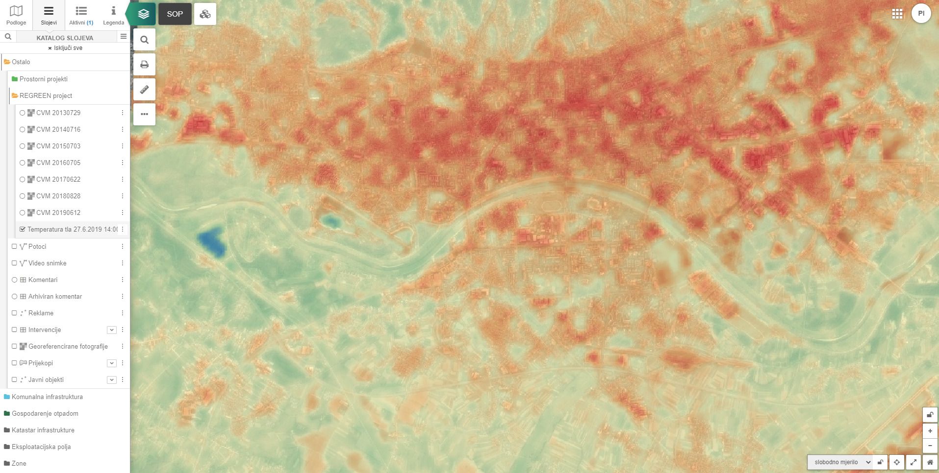
Monitor the impact of climate change in the administrative area of the local government unit.
Manage environmental factors by visualizing key environmental impact indicators.
It is possible to connect the pipGIS® solution with other systems and sensors. This enables a complete solution to support decision-making.
The module can have the following functionalities:
- Visualization and analysis
-
- typologies of public buildings
- energy indicators
- environmental impact indicators
- Monitoring the impact of climate change
- Strategic positioning of renewable energy sources
- Monitoring air quality via sensors
- Environmental management - spatial plans