Our main goal is to create dynamic webGIS solutions whose features we adapt to each user.

pipGIS®
pipGIS® application system allows the following:

Data management
pipGIS® web platform supports several modules with functionalities for entering, viewing, editing, analyzing, and downloading spatial data.
Numerous integrations
It is possible to integrate cameras, sensors, GPS and various software into a highly operable system, making pipGIS the central point of the business.
Improved communication
An unlimited number of users can share information in the system, which greatly facilitates the communication.
Contact us for joint cooperation!
Selected software solutions
The implementation of our solutions is unlimited - it's up to you to explore them!
Road surveying
360 ° panoramic georeferenced video brings a revolution in the road infrastructure and property of a local government unit management.
MORE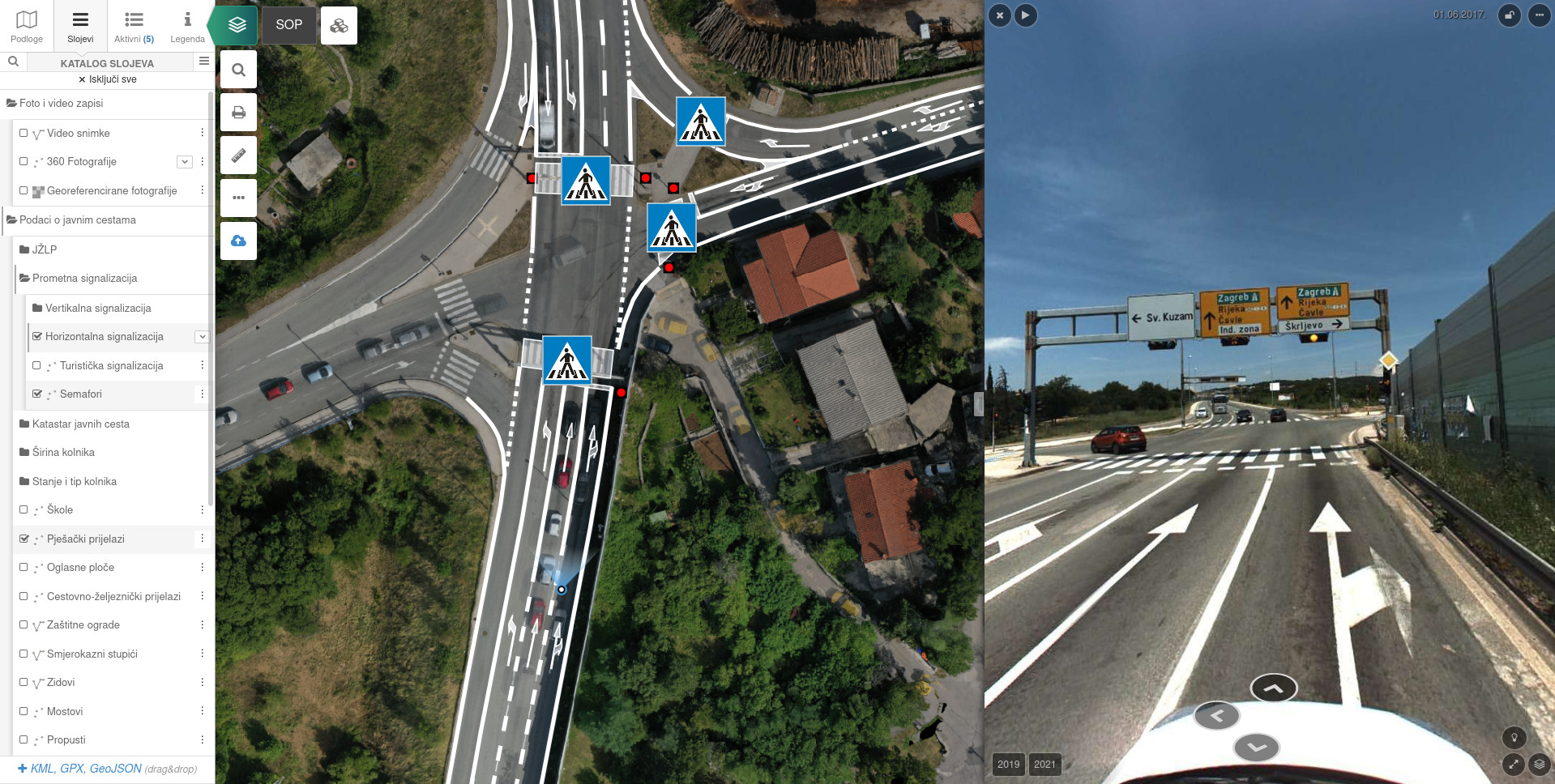
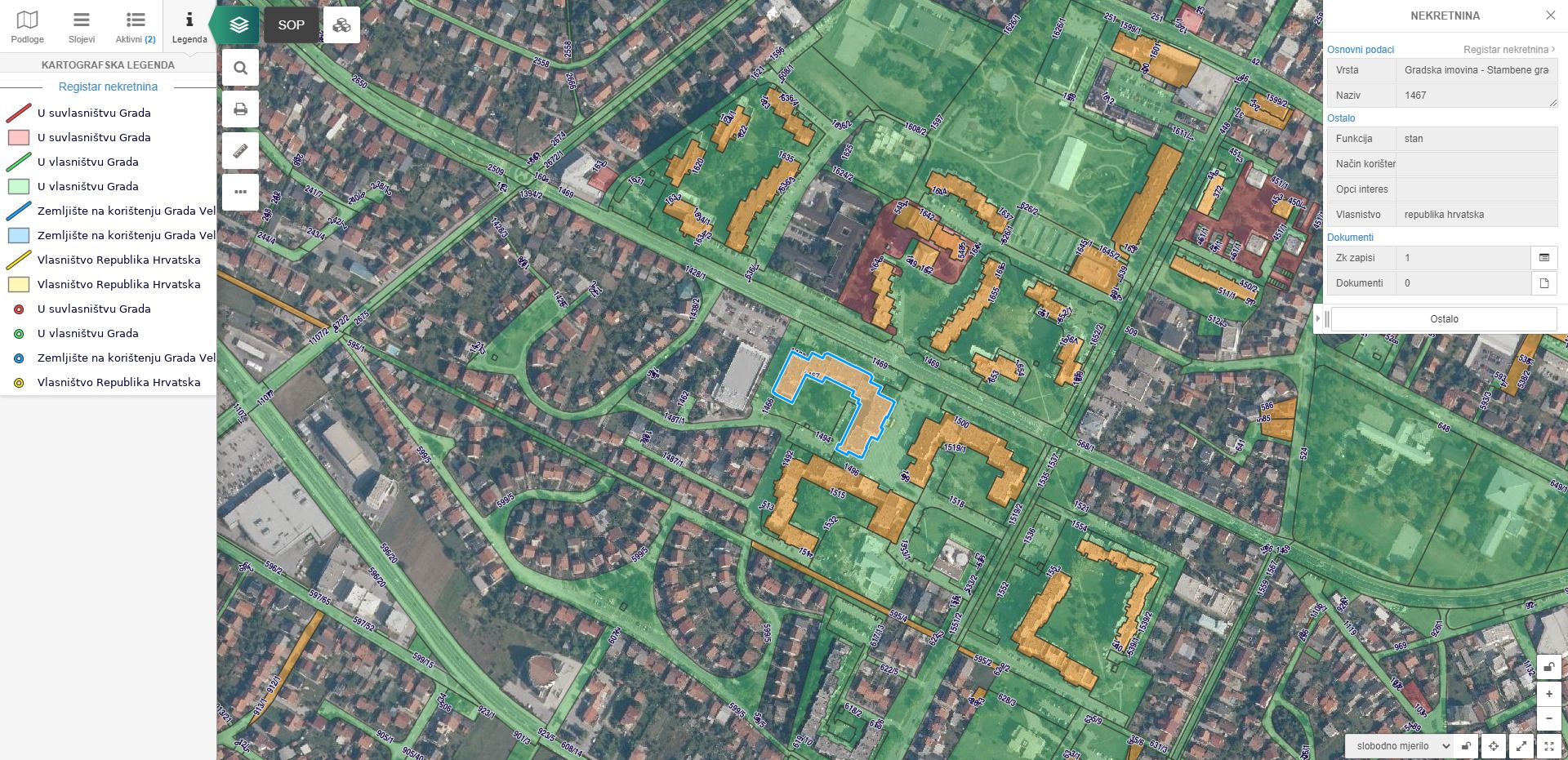
Real estate register
With the Real Estate Registry (ReNe), it is easier to manage real estate and all related documentation. The cartographic display of the property database enables logically structured management of real estate according to any attribute.
MORE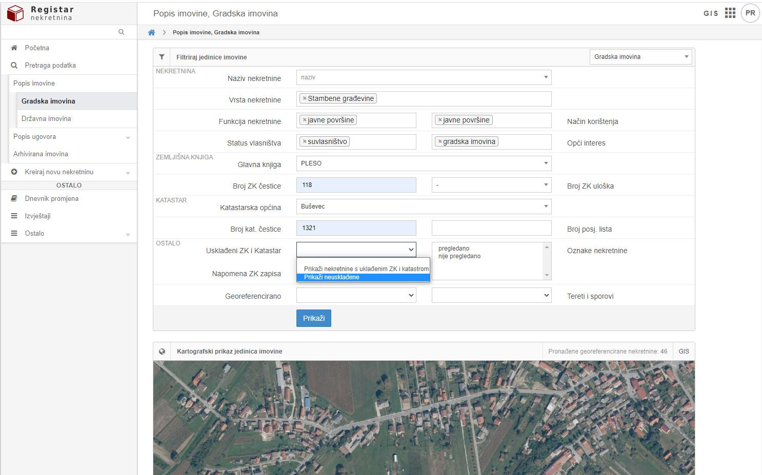
e-Interventions
The infrastructure maintenance system enables smart management of field work or interventions in such a way that each intervention is spatially, temporally, and categorically recorded in the system throughout its development cycle.
MORE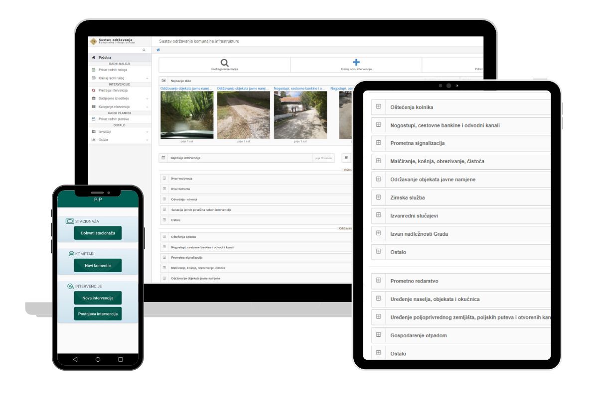
Spatial plans
Modern software solution for spatial planning documentation management for municipalities, cities or counties. Includes processing and input of spatial plans of related documentation.
MORE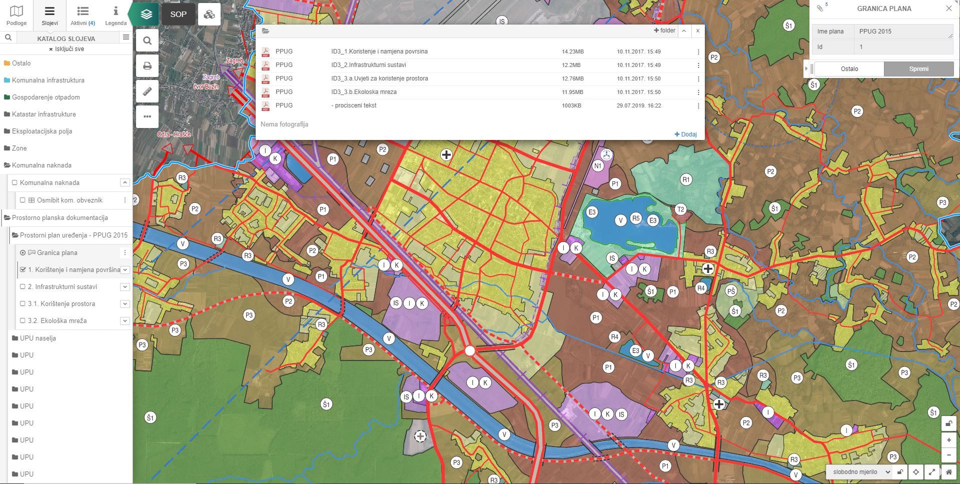
Waste management
pipGIS® module for efficient waste management in the administrative area of the local self-government unit. The module enables the display of all spatial data that is crucial for successful waste management.
MORE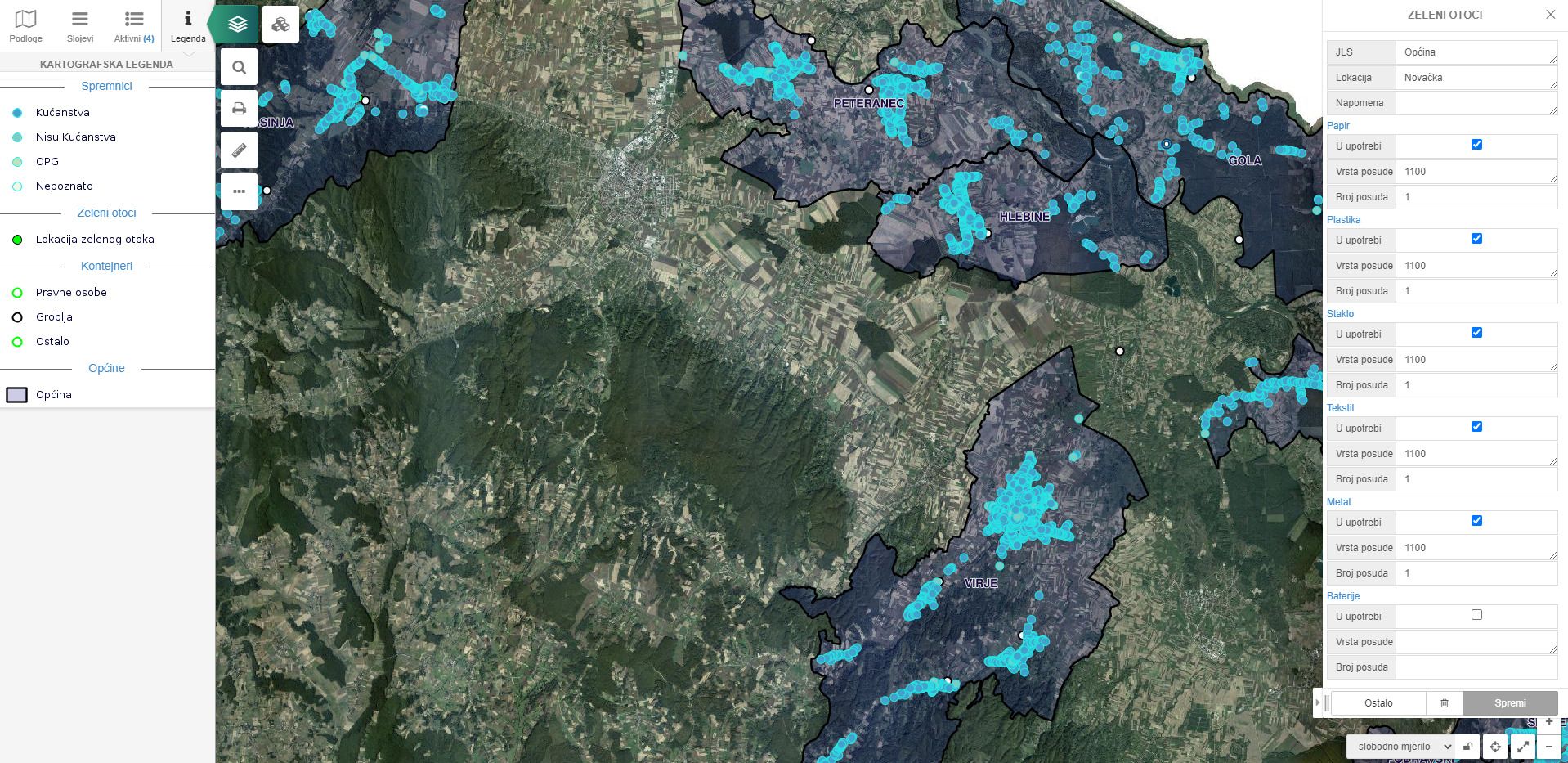
Our solutions are reliable, accessible, and interoperable.
We can customize each solution to your needs!
What are the advantages of our system?
Conceptual solutions customized to fit user's needs
Available
PiP solutions are available regardless of location and time – 24 hours a day!
The data can be accessed from a computer, tablet, or mobile phone via an internet connection.
Adaptable
We successfully adapt the system to the most demanding business processes of our users.
This feature keeps us market leaders and has been recognized through Smart City Awards.
Interoperable
There is a possibility for integration with other IT systems such as cameras, GPS, sensors, etc.
The solutions are open-sourced, which means that there is no installation or paying license to third parties.