Spatial plans
Modern software solution for spatial planning documentation management for municipalities, cities or counties.
EXAMPLES
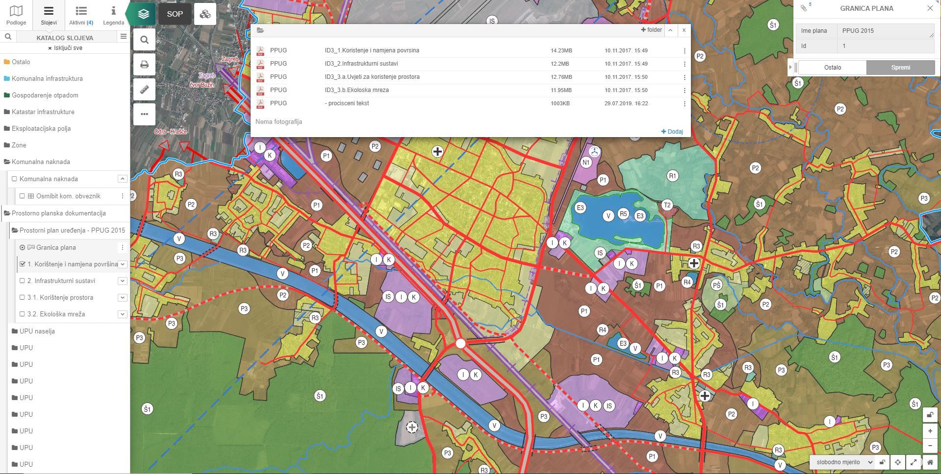
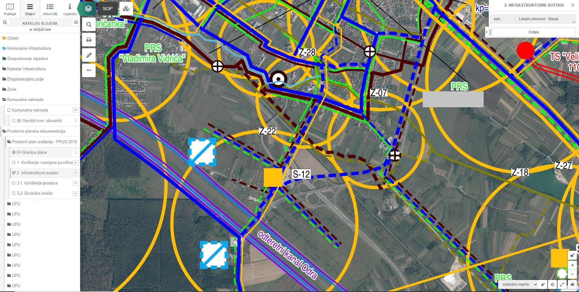
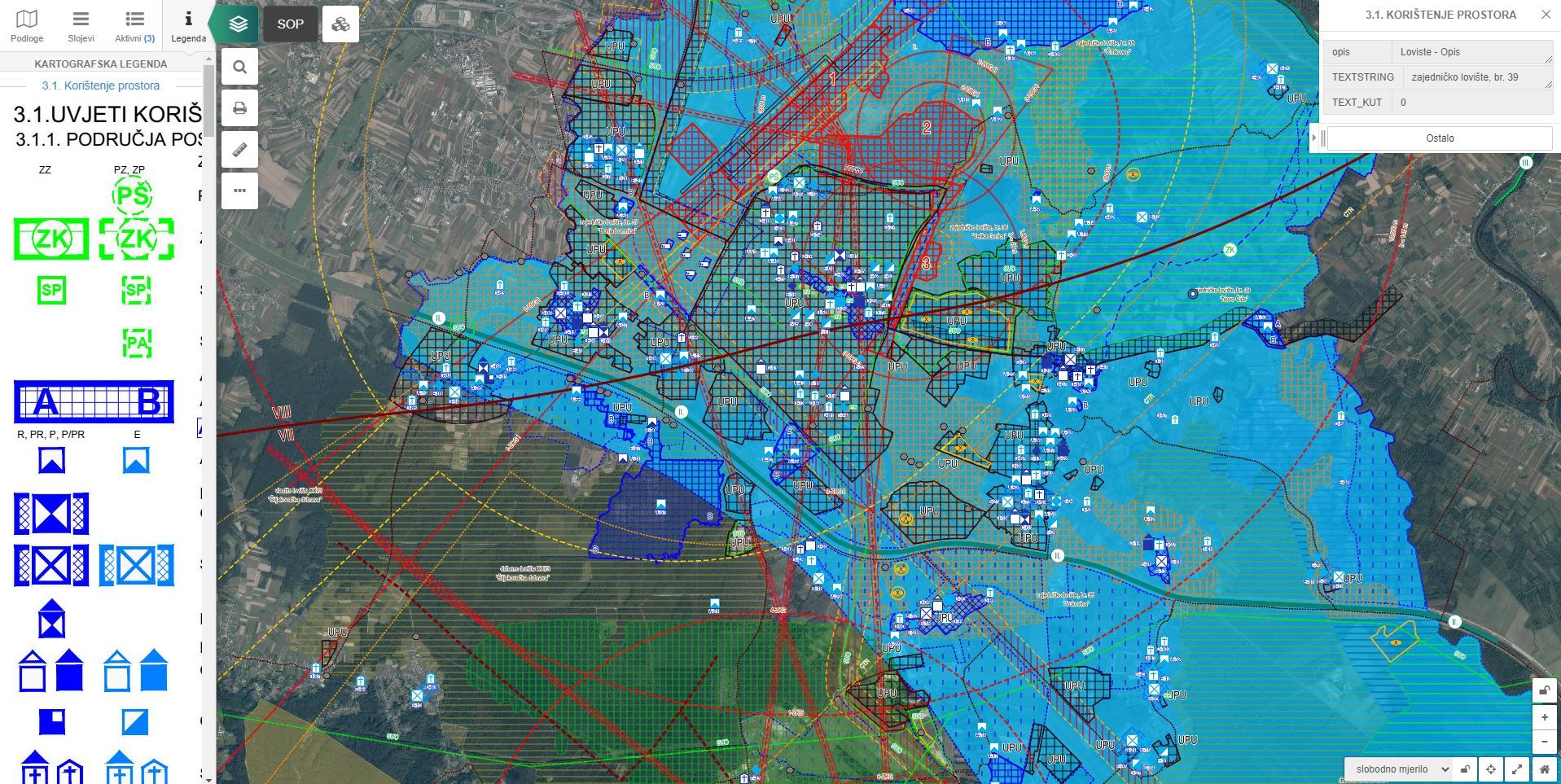
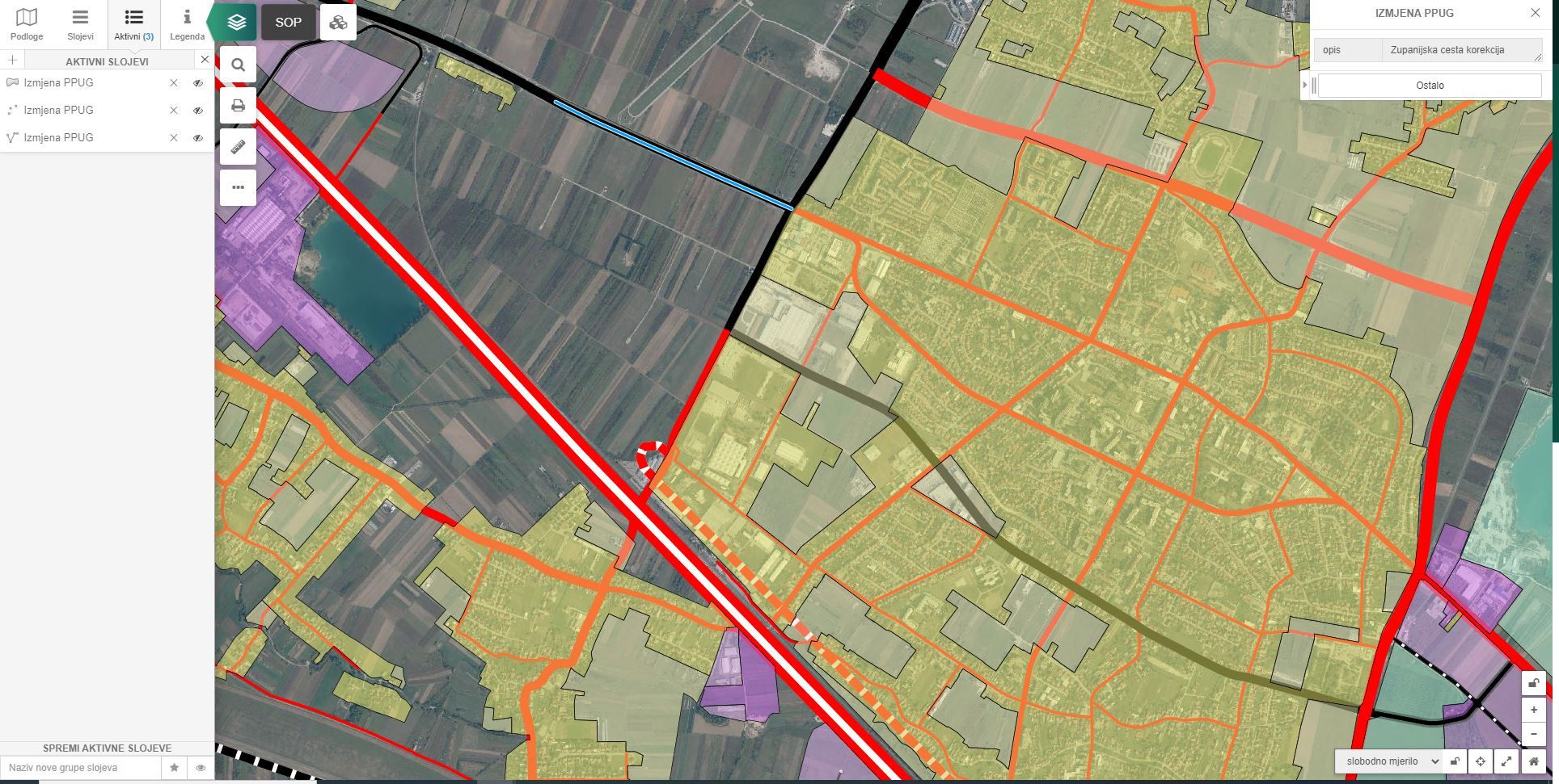
The spatial plans module includes:
- Base of spatial and urban plans - internal base
- Associated attributes related to a specific data from the spatial plan
- Overview of spatial plans with inclusive layer transparency
- Search by cadastral parcels
- Downloading text files (terms, legends, components, etc.)
The service of collecting and processing data of spatial and urban plans
and their entry into the database includes:
- Data analysis, preparation and sorting (.dwg data)
- Data processing and transformation into GIS format
- Data stylization
- Data entry into the webGIS database
Additional option with the module spatial plans:
Setting up a public service for proposing changes to spatial plans for citizensInvestments and projects
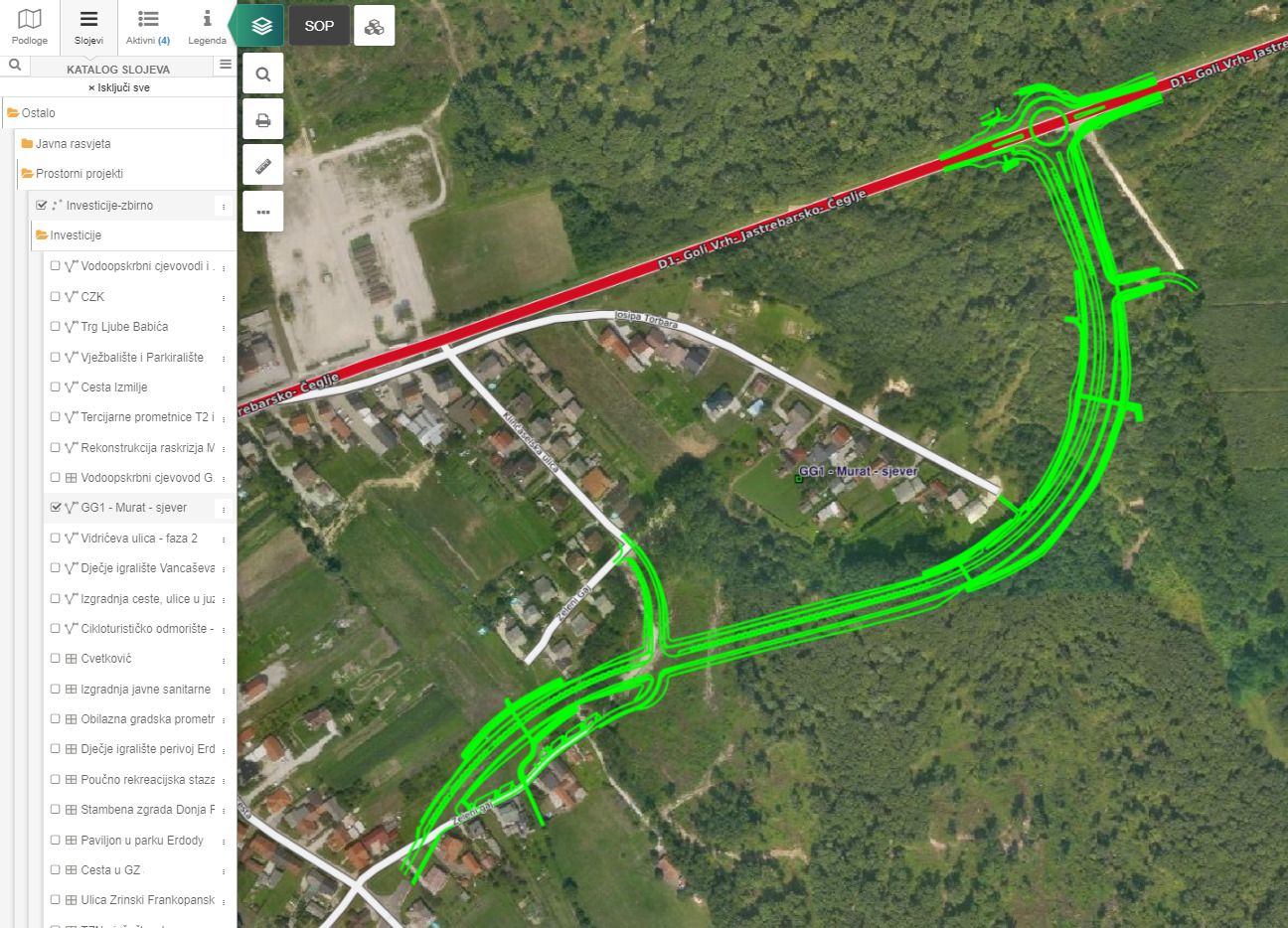
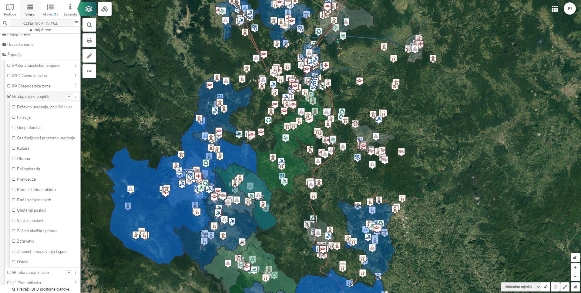
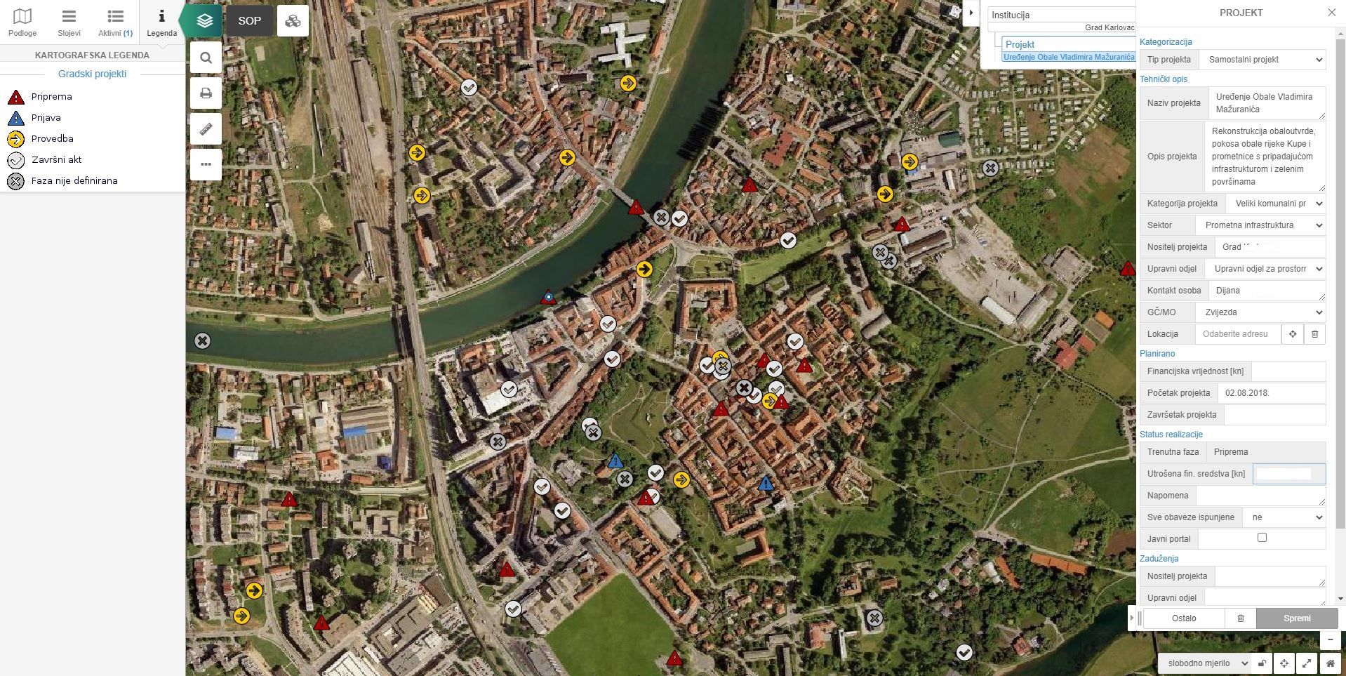
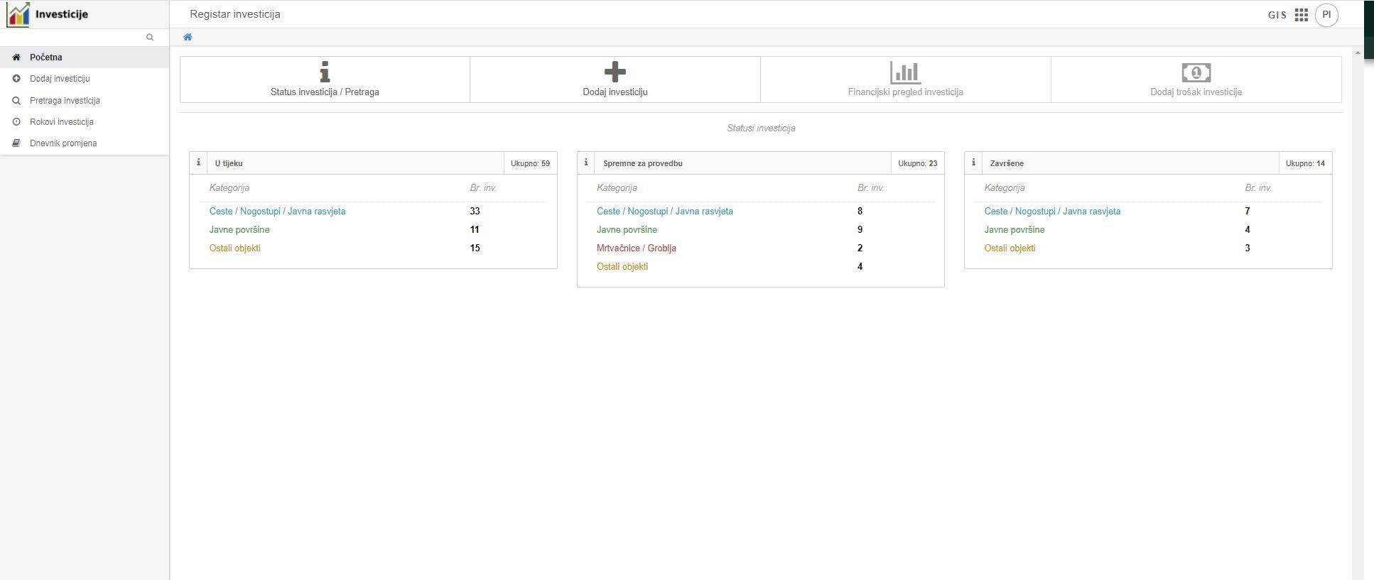
Manage investments and projects in a systematic way with webGIS smart solution for managing spatial planning documentation.
The module can have the following functionalities:
- Schedule of investments and projects by cost center
- Monitoring of investments and projects by phases
- Supervision of work execution
-
- attaching handover records, monitoring of works, etc.
Follow the stages of solving individual investments and plan new ones!
- Systematic record keeping
- Notifying users about permit expiration
- Presentation of city investments/projects to interested citizens
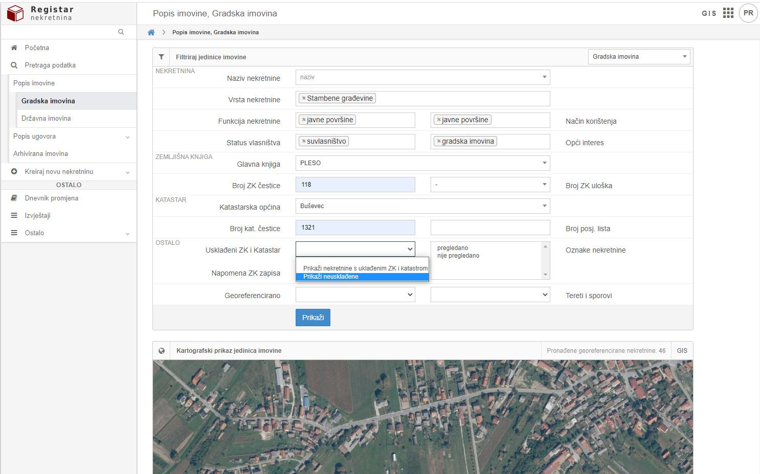
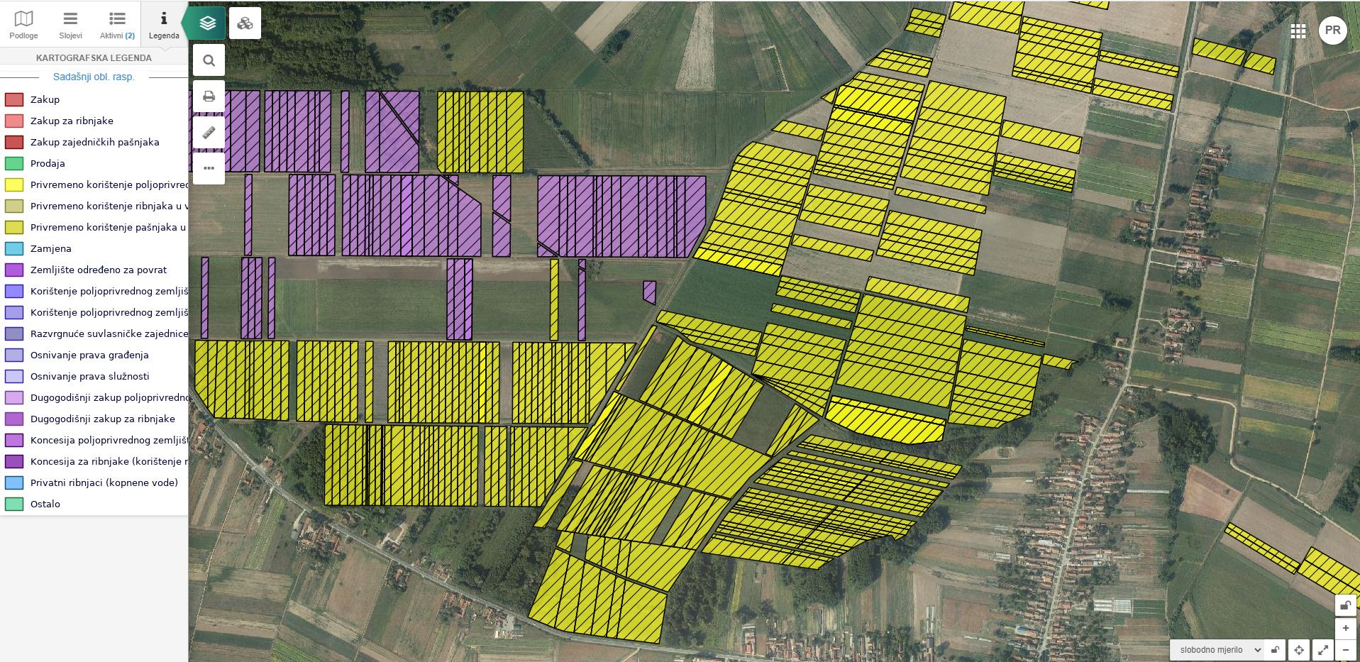
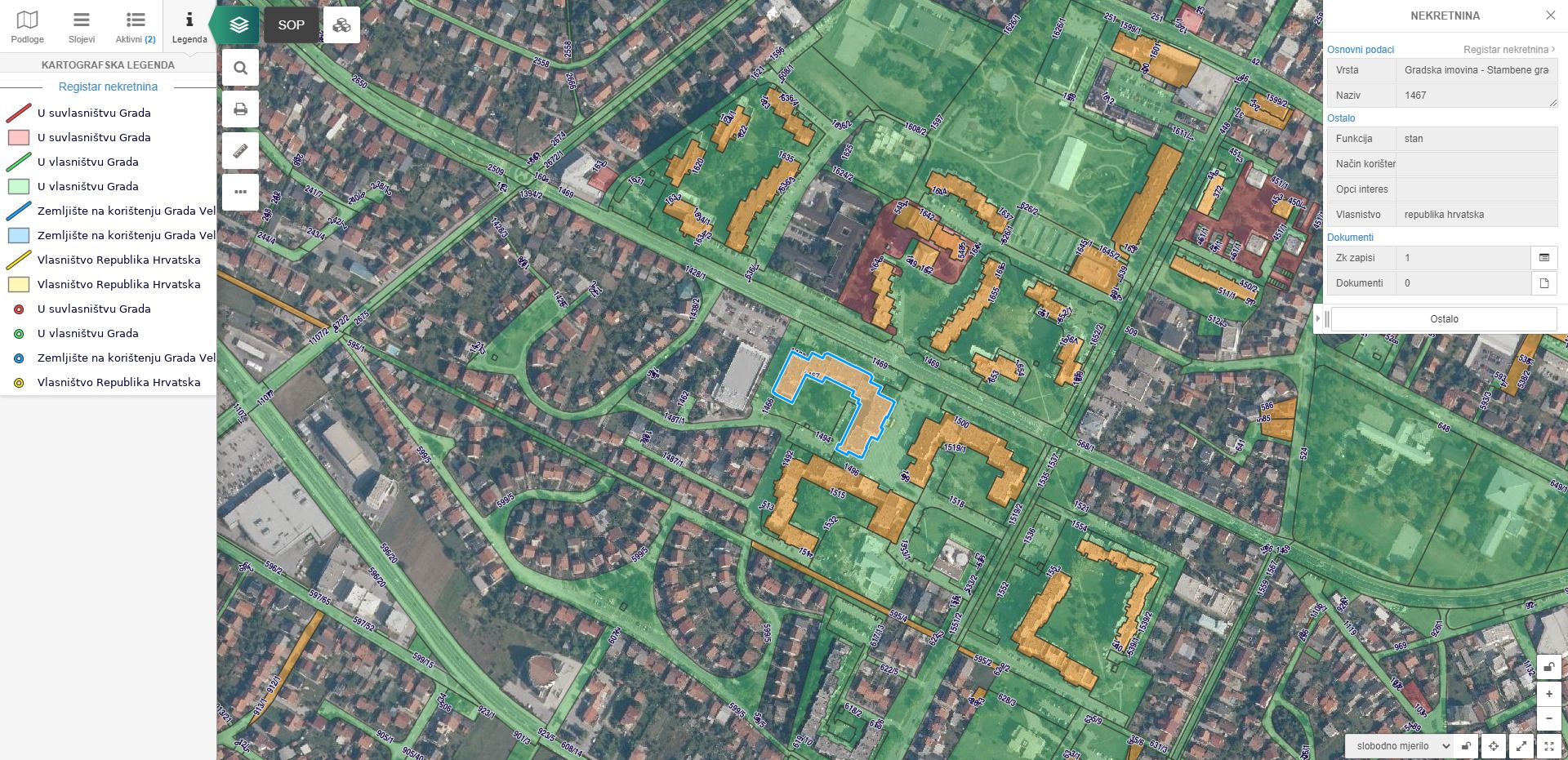
Income and asset
EXAMPLES
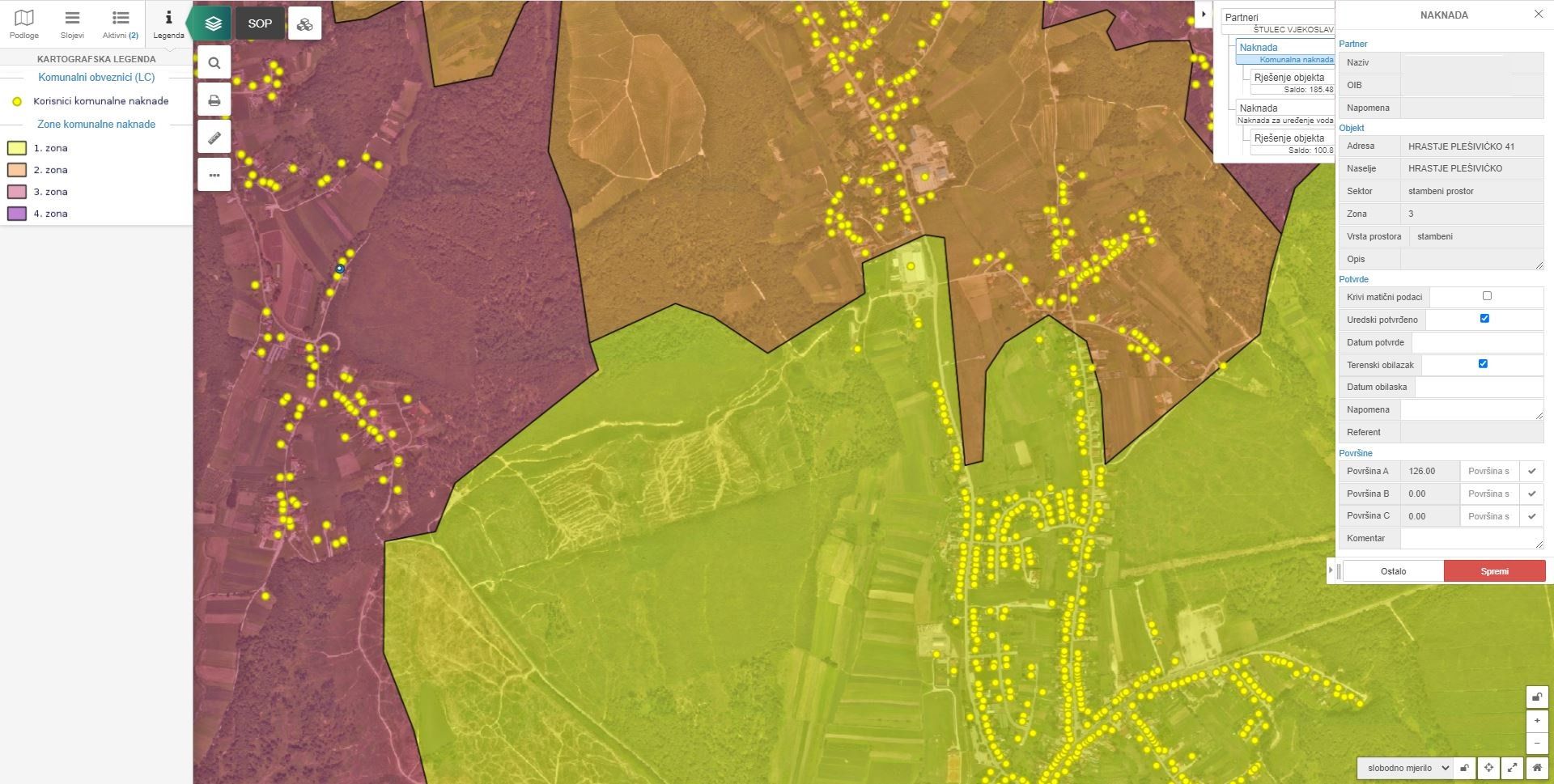
Real estate visualization = better asset management
The solution can contain the following modules:
- Real estate register - unified asset database
- Agricultural land - review and management of the database of agricultural lands
- Optimization of city revenue management
-
- utility fee zones
- records of utility payers
- utility contribution zones
- accommodation capacity
- tourist facilities
- Parcel ownership
- Assessment studies
- Real estate value
- Line cadastre