e-Interventions
Organizational software solution that enables smart management and administration of field work interventions in such a way that each intervention is spatially, temporally, categorically and financially recorded in the system throughout its development cycle.
EXAMPLES
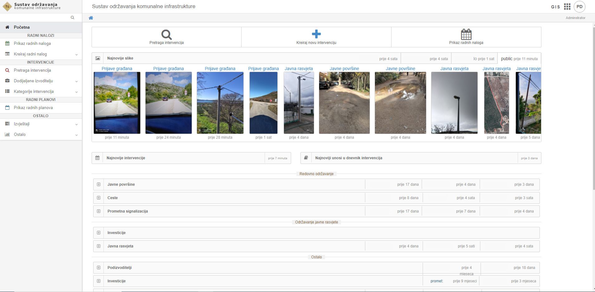
e-Intervention system functionalities:
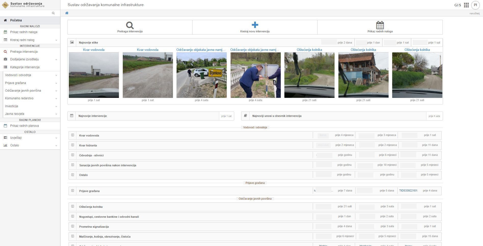
- Display of all interventions according to current status
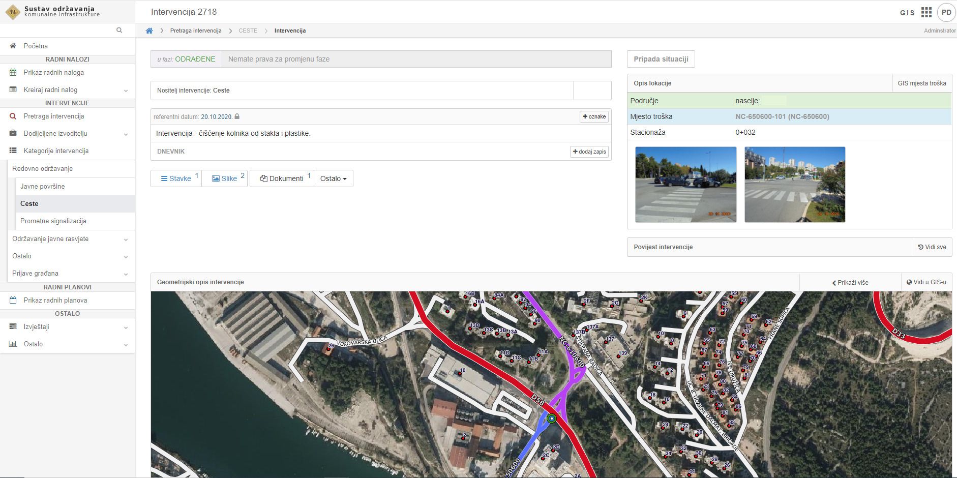
- Review and inspection of performed interventions
- Records of comments of all involved entities
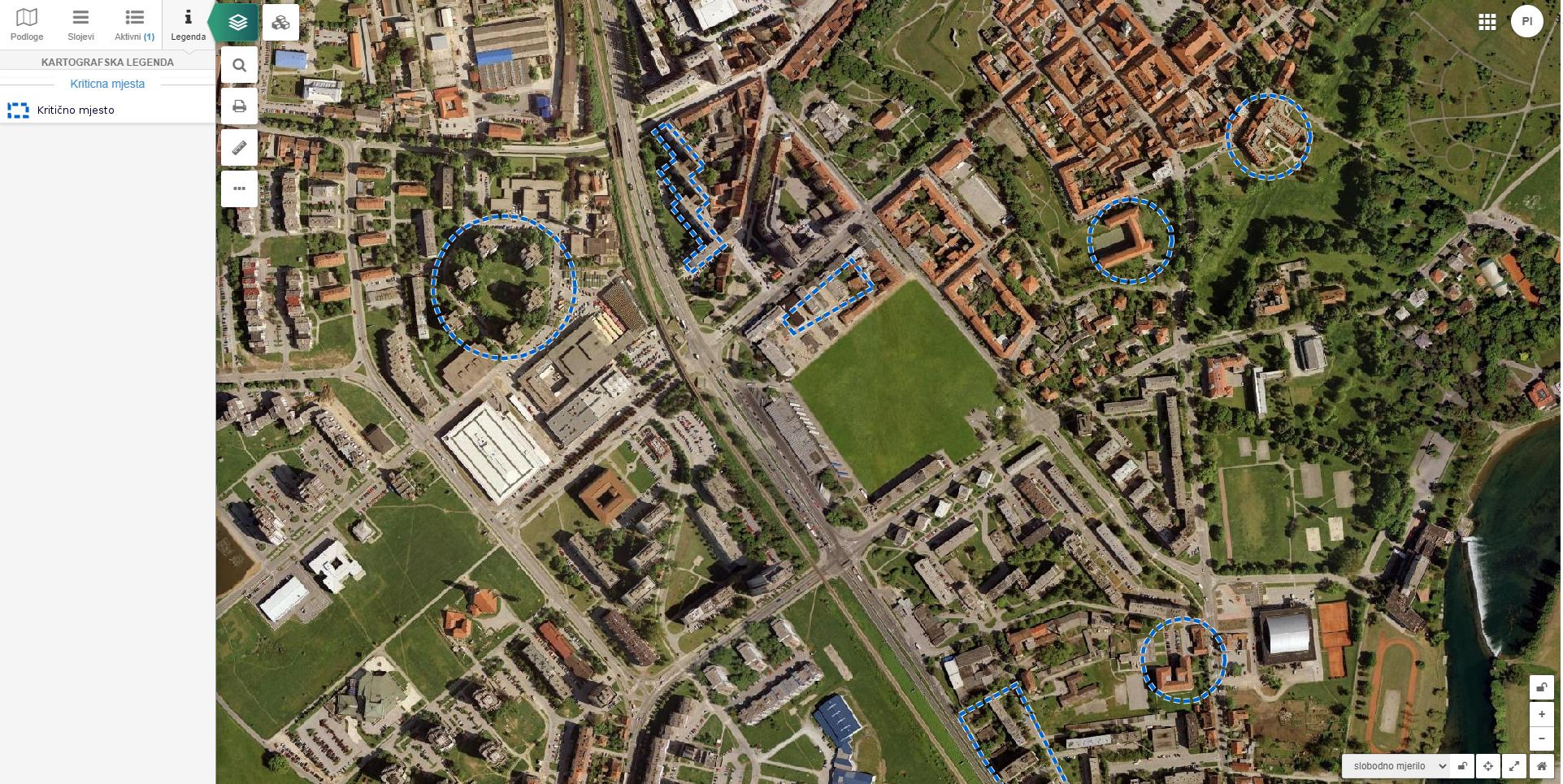
- Search and analysis of performed interventions according to all criteria (spatial, financial, according to the responsible person, etc.)
- Input and marking photos before, during and after finished work
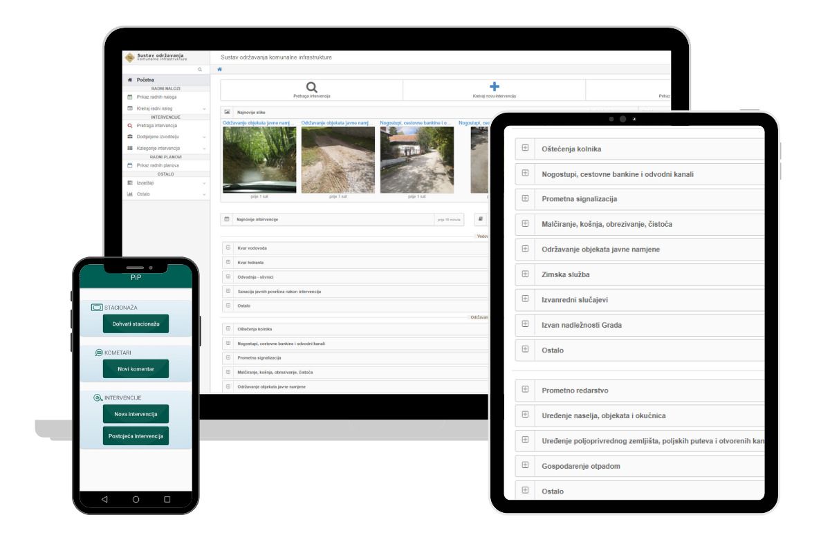
The system includes a specially designed Android application
, which greatly facilitates field work
- Offers, approvals and invoices are created through integrated cost sheets through the system
- Creating work orders
- Creating specialized reports
- Review of spent material in a certain period of time
- Management of access rights and user activities
- Sending email notifications to users depending on defined criteria
Integrations with other systems
EXAMPLES
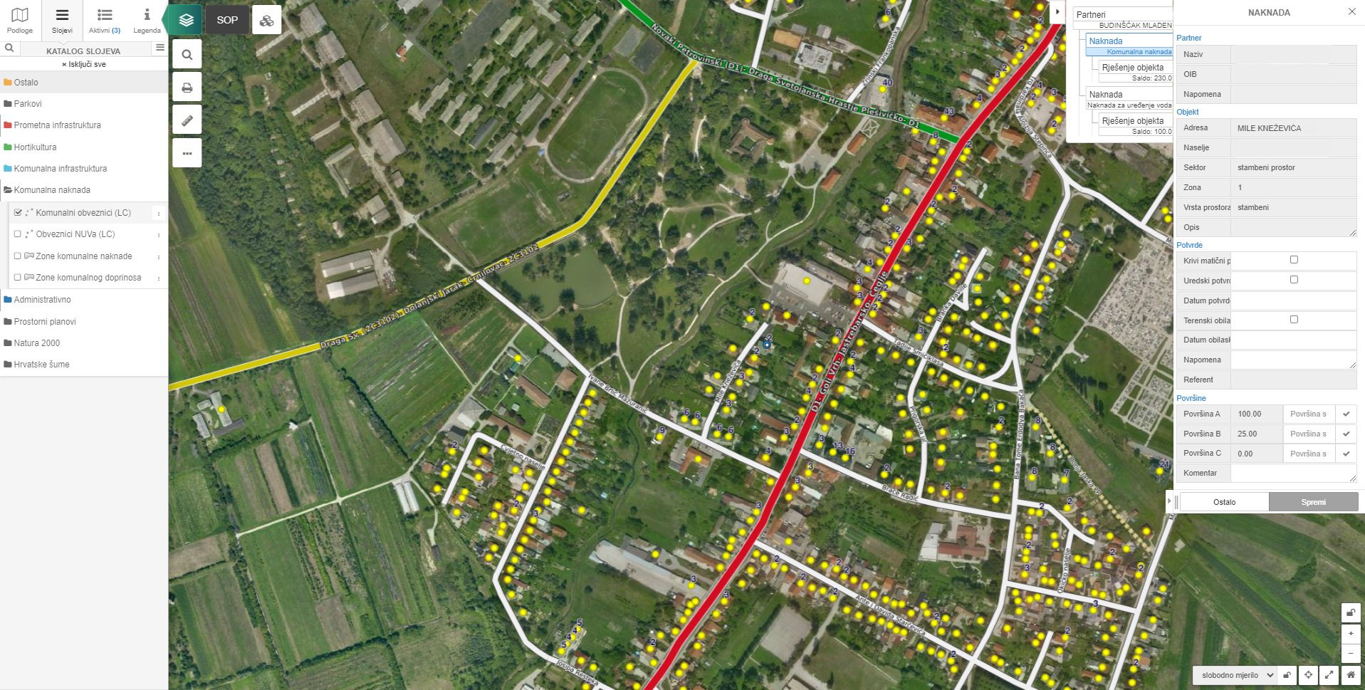
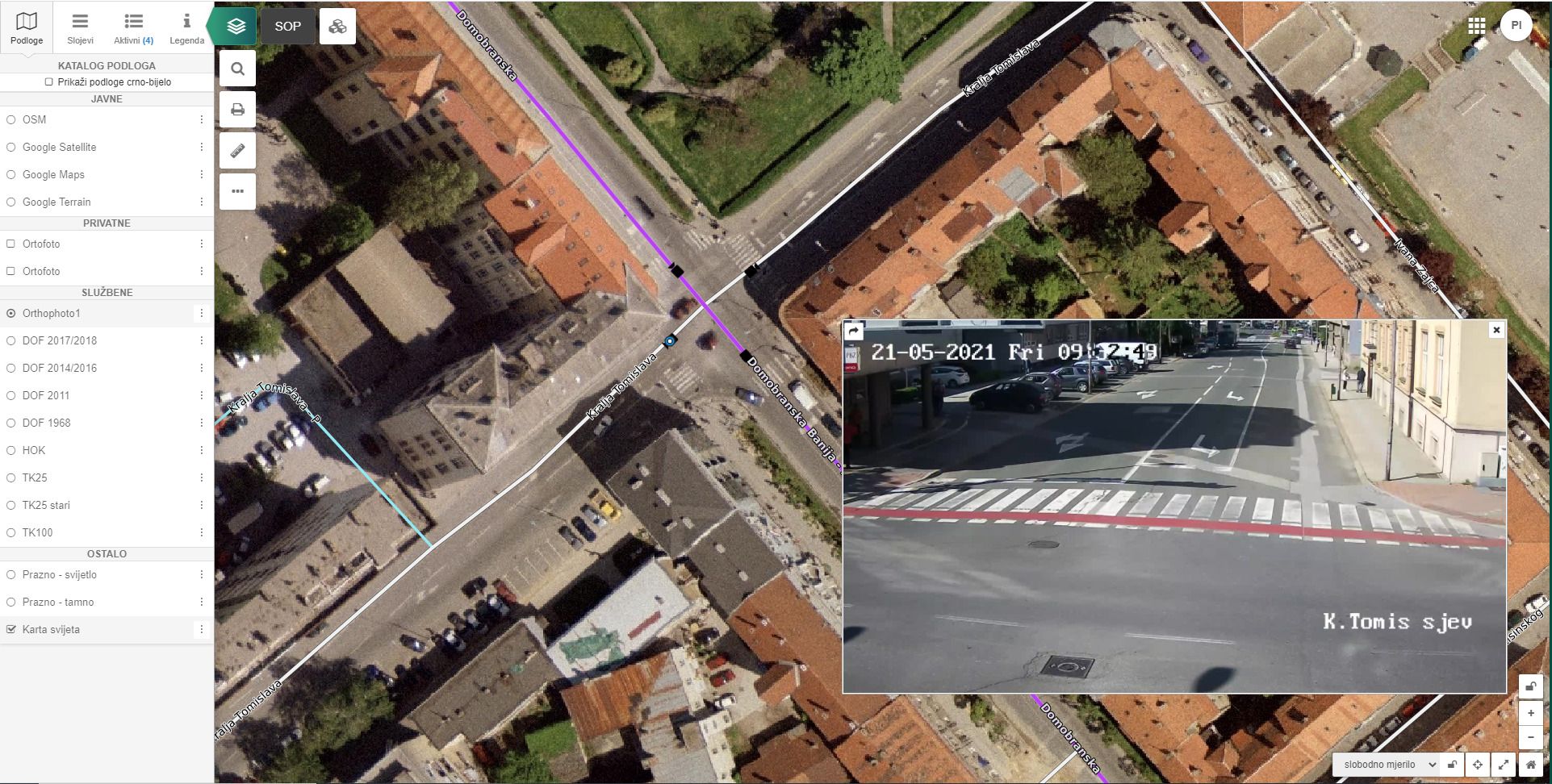
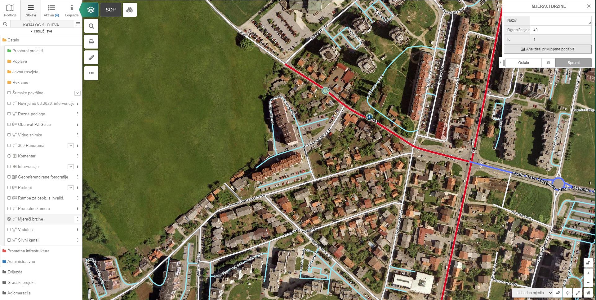
pipGIS® is a highly interoperable open source program within which integration with other business and GIS applications, as well as sensors, cameras and other external systems is possible.
Combines the available data and a single database that is easy to handle
Some of the integration options are:
- OKOLO.hr
-
- georeferenced aerial panoramic images
- Vehicle tracking (GPS)
-
- display of the dynamic data of the current vehicle location in real time
- ERP systems
-
- e.g. records of those liable to pay utility fees
- ARKOD (display of agricultural land)
- Traffic counters and speedometers
- "Hrvatske šume" - the area of state and private forests
- Natura 2000 - eco-protected areas
- Traffic cameras
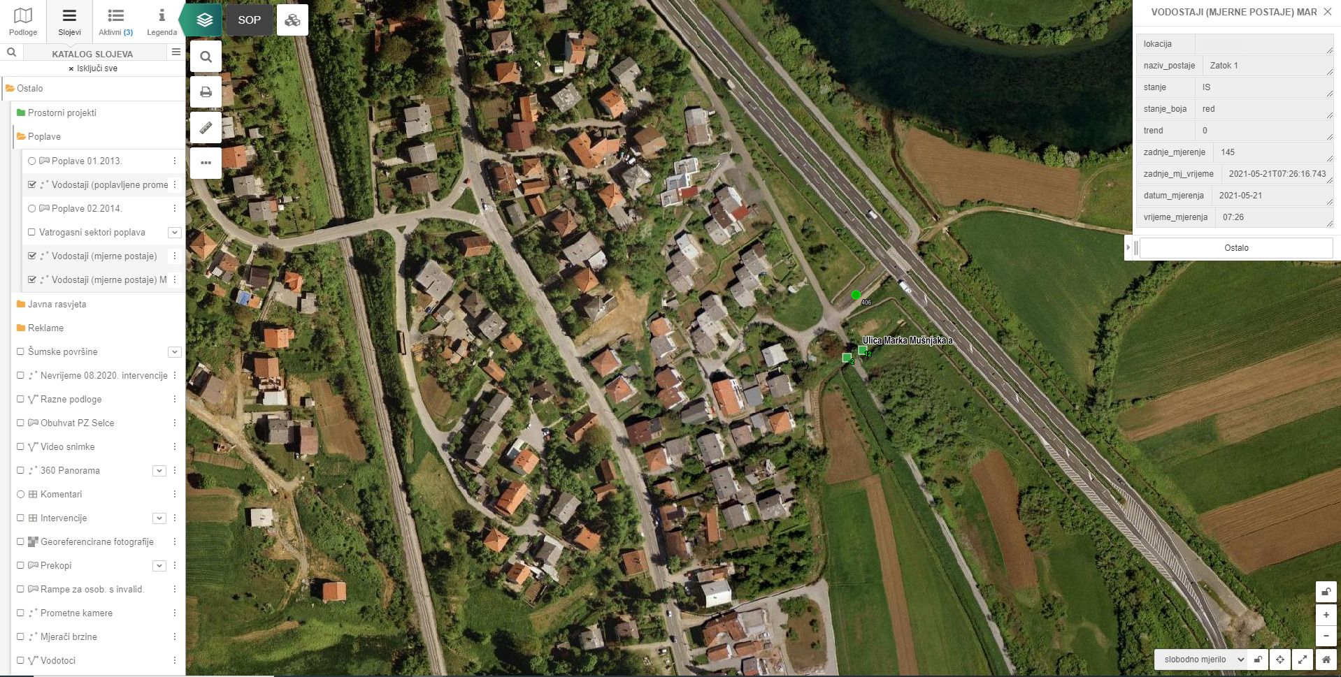
- "Hrvatske vode" - water level monitoring
- DGU
Applications
For the smooth use of our solutions in the field, we have designed a range of applications that facilitate work processes at any time. All you need is an internet connection and you are ready to collect data that is displayed directly in the pipGIS system.
EXAMPLES
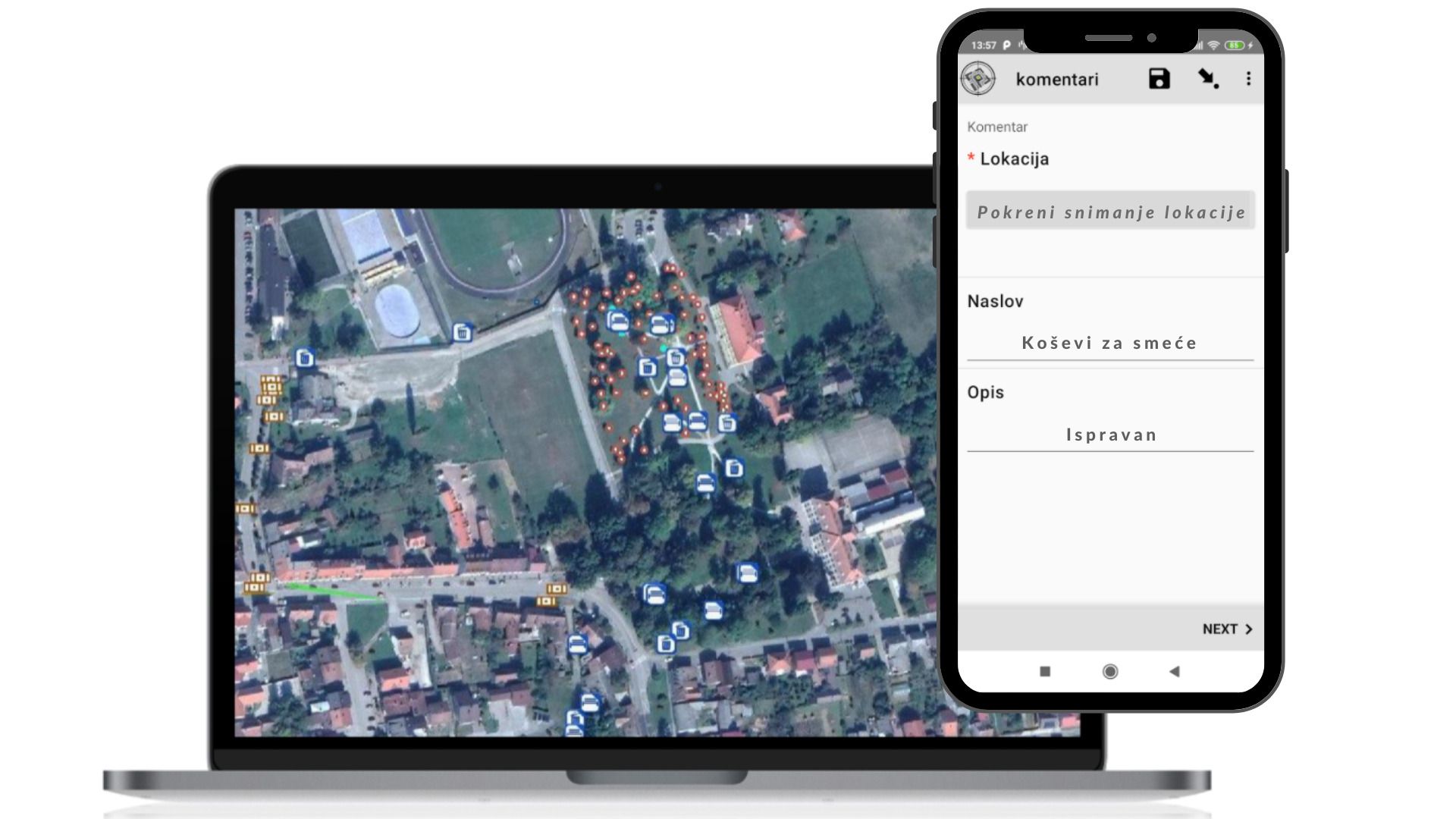
- pipODK for field data collection
-
- application designed to facilitate the entry of the entire utility infrastructure, but can also be used for:
https://www.youtube.com/watch?v=742X5tH0HTM
- application designed to facilitate the entry of the entire utility infrastructure, but can also be used for:
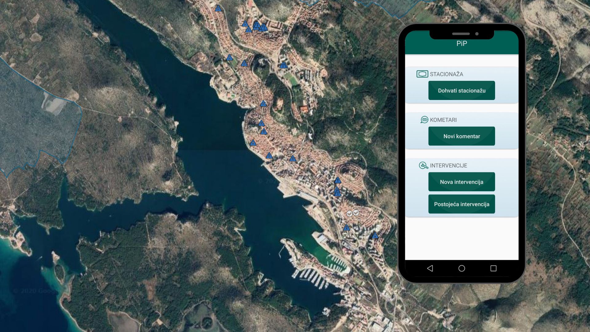
- PiP regular application for field work
-
- a free application that is an integrative part of the pipGIS® system for field conditions (making spatial notes, retrieving the stationing of individual sections, etc.)
- Popravimo.hr
-
- the purpose of the application is to enable citizens to quickly and easily enter the shortcomings related to utility infrastructure through georeferenced photos
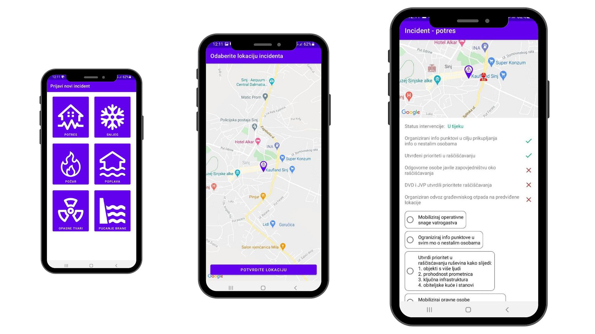
- Crisis management
-
- a system in which citizens can register and share their location in case of disaster, with the Civil Protection Headquarters having access to them in an organized manner
Public services for citizens
A separate web application that displays layers of data from the internal database of the pipGIS® application according to the user's wishes with the aim of simply and transparently informing potential investors and the interested public.
EXAMPLES
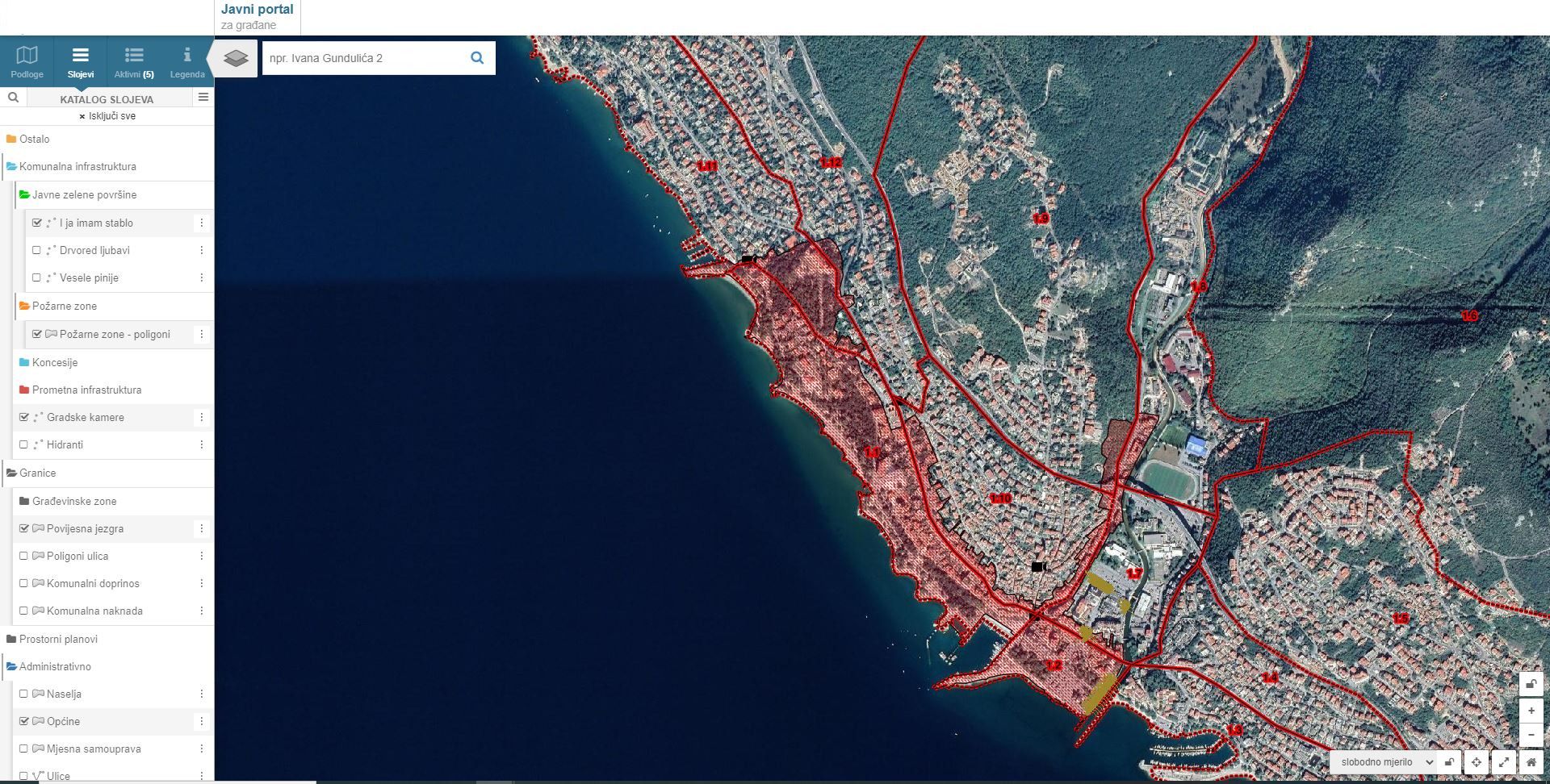
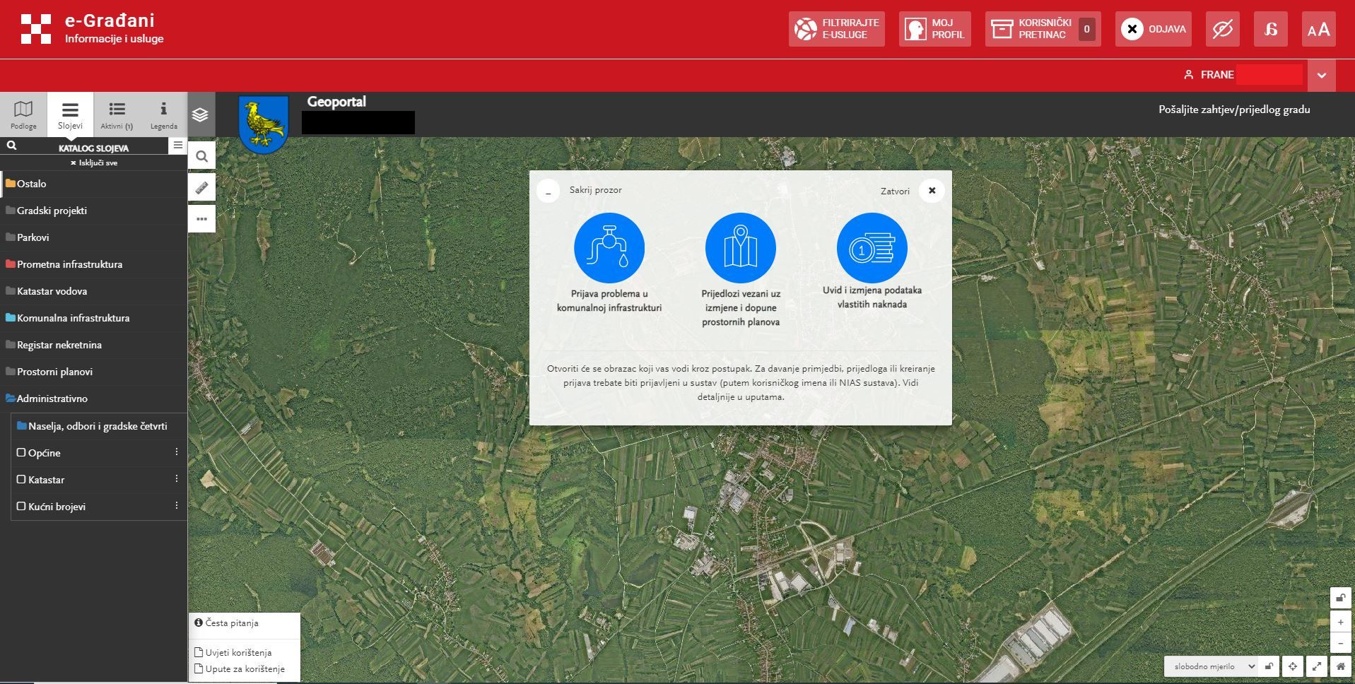
The module can have the following functionalities:
- Transparent display of spatial data of the city, municipality or county
-
- public portal for data insight under the authority of the local self-government unit
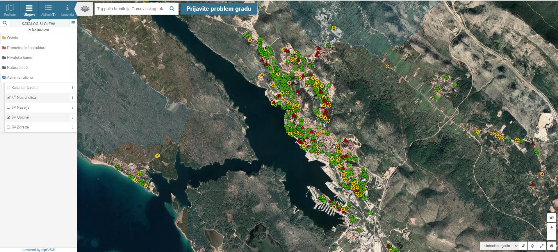
- Reporting deficiencies related to utility infrastructure (Popravimo.hr)
-
- an application that enables citizens to easily report identified problems and monitor the progress of solving them
Simple, modern and efficient!
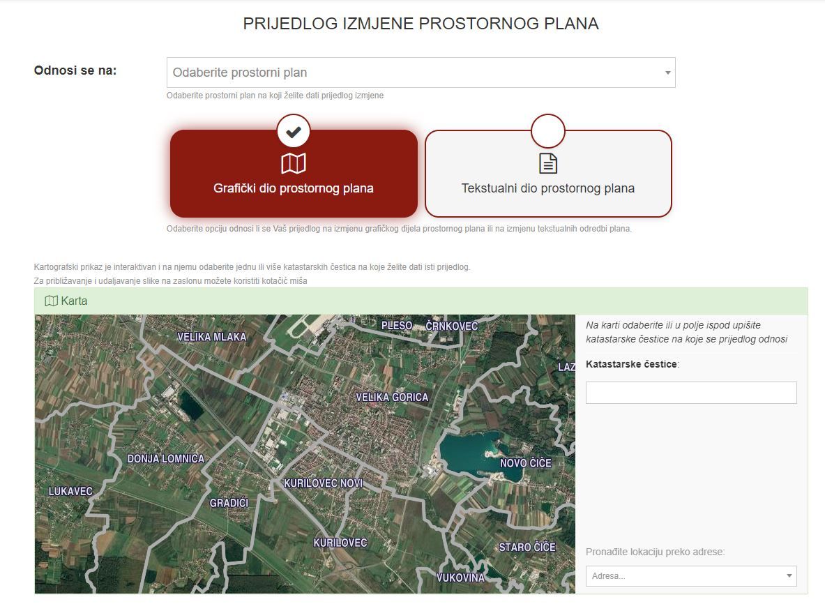
- Giving proposals for changes to spatial plans
-
- active involvement of citizens in the processes of adopting and changing the graphic or textual part of spatial plans
- Request for changing the utility fee
-
- citizens can submit a request to change the data of the utility fee through the public portal
- the system can be integrated with the e-Citizens service